




Click the photo to view the full-size version
| Name | Pioneer Trail - Black Hawk Creek Bridge Chicago, Rock Island & Pacific Railroad Bridge #701 |
| Built By | Chicago, Rock Island & Pacific Railway |
| Currently Owned By | Grundy County Conservation Board |
| Superstructure Contractor | American Bridge Company of New York |
| Substructure Contractor | Unknown |
| Length | 90 Feet Total |
| Width | 1 Track |
| Height Above Ground | 15 Feet (Estimated) |
| Superstructure Design | Through Plate Girder |
| Substructure Design | Stone Masonry |
| Date Built | 1907 |
| Traffic Count | 0 Trains/Day (Bridge is Open to Pedestrian Traffic) |
| Current Status | Open to Pedestrian Traffic |
| Chicago, Rock Island & Pacific Railroad Bridge Number | 701 |
| Significance | Local Significance |
| Documentation Date | 9/24/2017 |
In 1873, the Burlington, Cedar Rapids & Minnesota Railway (BCR&M) constructed 24 miles of new railroad, extending from an existing line at Vinton, Iowa to Traer, Iowa. In 1877, the Burlington, Cedar Rapids & Northern Railway constructed an additional 24 miles of new railroad, extending from Traer to Holland. In 1878, the BCR&M was acquired by the BCR&N. In 1880, the Cedar Rapids, Iowa Falls & Northwestern Railway (CRIF&NW) constructed an additional 79 miles of new railroad, extending from Holland to Clarion, Iowa. The following year, an additional 59 miles of railroad were constructed, reaching Emmetsburg, Iowa. In 1882, an additional 70 miles of new railroad were constructed, extending from Emmetsburg, through Estherville and Lake Park, Iowa, to Worthington, Minnesota. In 1884, the line was completed from Lake Park, through Pipestone, Minnesota, to Watertown, South Dakota. The CRIF&NW was leased by the BCR&N in 1884. Throughout the 1880s, the BCR&N became a major railroad in Iowa, connecting towns in the eastern and northern portions of the state. This line served as a secondary mainline for the BCR&N, providing access to agricultural areas in northwest Iowa, southwest Minnesota and east central South Dakota. In 1900, the CRIF&NW constructed an additional 36 miles of new railroad, extending from Worthington to Hardwick, Minnesota, on the existing line. The CRIF&NW was outright purchased by the BCR&N in May 1902. The BCR&N was in turn purchased by the Chicago, Rock Island & Pacific Railway (Rock Island) in June 1903. The Rock Island operated a large railroad network through the central United States, serving diverse industries.
Between Vinton and Estherville, the Rock Island operated this line as a secondary line. The Rock Island operated the lines towards Watertown as branch lines. The Rock Island struggled financially throughout much of its history, experiencing repeated bankruptcies and chronic instability. After World War II, the Rock Island struggled to survive, proposing mergers and deferring maintenance on their routes. The railroad reorganized as the Chicago, Rock Island & Pacific Railroad in 1948. A section between Luverne, Minnesota and Kanaranzi, Minnesota was abandoned in 1962. In 1969, the Rock Island abandoned segments between Lismore, Minnesota and Watertown; between Ellsworth, Minnesota and Karanzi and between Luverne and Hardwick. By the mid-1970s, the railroad was in serious decline. The railroad secured loans to eliminate slow orders, acquired new equipment, and attempted to restore profitability. A short section from Little Rock, Iowa to Ellsworth was abandoned in 1977. In 1978, the railroad came close to profit, but creditors were lobbying for a complete shutdown of the Rock Island. During the fall of 1979, a strike crippled the railroad, and by January of 1980, the entire system was ordered to be shut down and liquidated. Many of the lines and equipment were scrapped. Profitable sections of railroad were prepared for sale. In 1980, several sections of this line were abandoned, including the Traer to Dows section; the Clarion, Iowa to Goldfield, Iowa section; the Lake Park to Lismore section section and the Sibley, Iowa to Little Rock section.
Three separate lines of this line were sold to other railroads. Between Vinton and Dysart, the line was acquired by the Iowa Northern Railway (IANR) for use as a branch line. Between Dows and Clarion, the Chicago & North Western Railway (C&NW) acquired the line as an industrial lead. Between Goldfield and Sibley, the line was also sold to the C&NW for use as a secondary line to serve agricultural industries. A short segment between Allendorf, Iowa and Sibley, Iowa was abandoned by the C&NW in 1981. It is believed that the Superior, Iowa to Allendorf segment was sold to the Iowa Northwestern Railroad (IANW) around the same time. In 1994, IANR abandoned the Vinton to Traer segment of this line. In 1995, the C&NW was acquired by Union Pacific Railroad (UP). IANW abandoned the line between Ocheyedan, Iowa and Allendorf in 2004, followed by the segment between Superior, Iowa and Ocheyedan in 2008. Today, UP operates the Estherville Subdivision between Goldfield and Superior, as well as the Dows Industrial Lead between Dows and Clarion. Three sections of the line have been reused as trails, including the segment between Vinton and Dysart as the Old Creamery Trail, the segment between Reinbeck and Holland as the Pioneer Trail and the segment between Allendorf and Sibley as the Ed Winkel Memorial Trail. An additional trail is currently being developed between Superior and Allendorf, and will be known as the Iowa Great Lakes Trail.
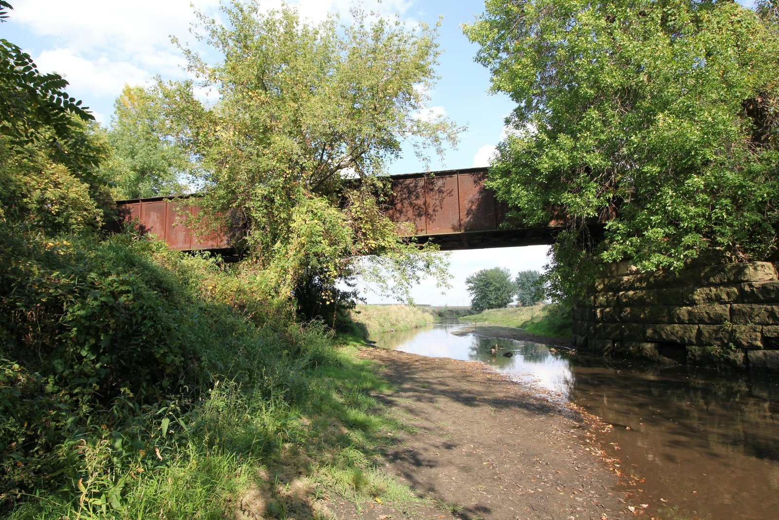
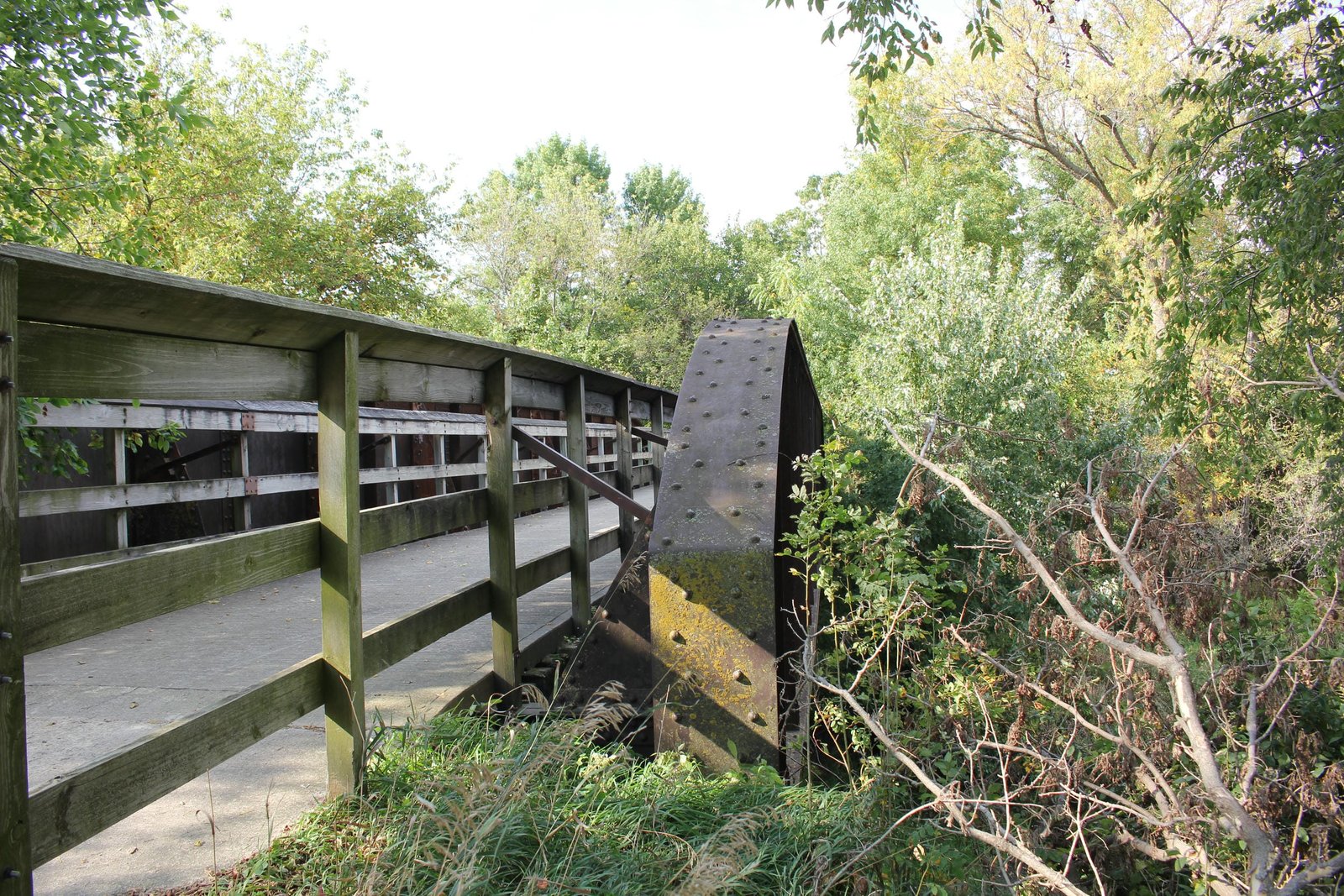
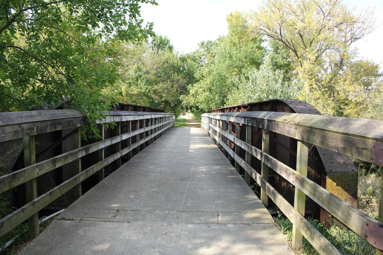
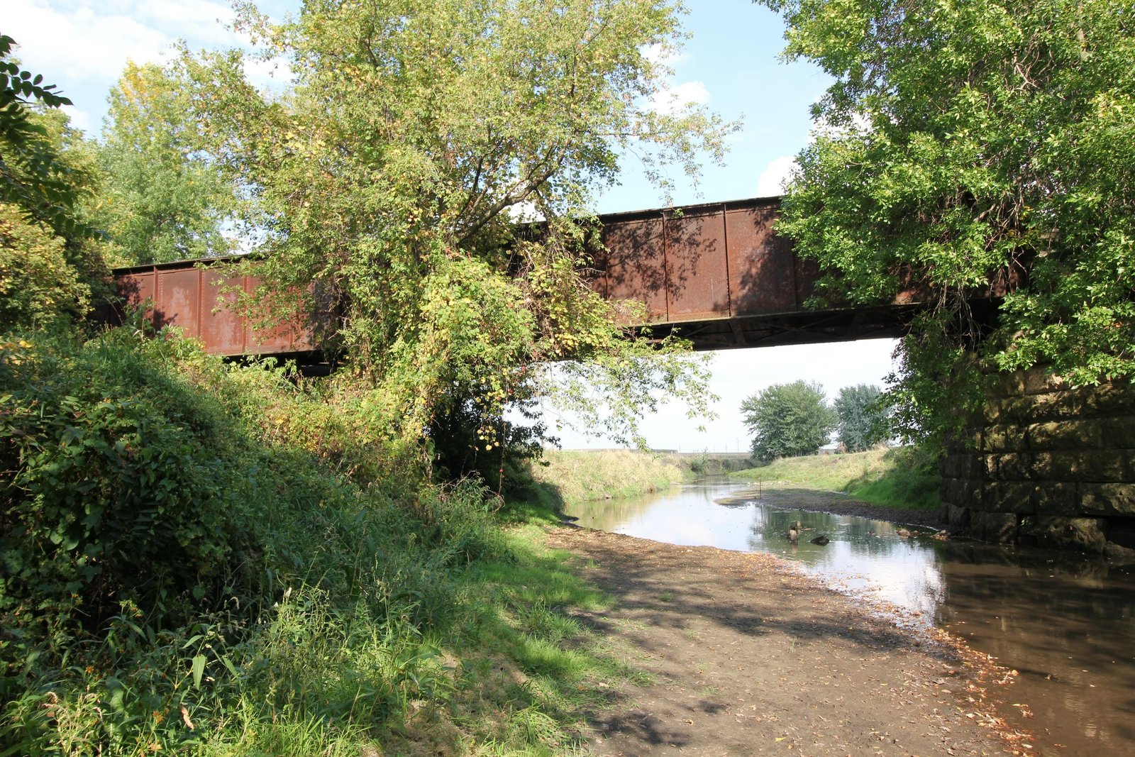
Located near M Avenue between Grundy Center and Holland, this through plate girder bridge carries a former Chicago, Rock Island & Pacific Railroad (Rock Island) secondary line over Black Hawk Creek. Portions of the history of this bridge are unclear. The first bridge at this location was likely a timber pile trestle, constructed when the line was first built. In the late 1890s and early 1900s, the BCR&N and successor Rock Island made several upgrades to this line, replacing timber bridges with steel, stone and concrete structures. In approximately 1895, it is believed that a deck plate girder span set onto stone abutments was constructed at this location. For an unknown reason, the bridge was replaced by the present through plate girder span in 1907. It is unclear but possible that the original span was reused at another location. Currently, the bridge consists of a 90-foot through plate girder span, set onto stone abutments. The superstructure follows a standard design, with two massive plate girders, a standard floor system and curved and tapered girder ends. Both abutments follow a standard design, with stepped wing walls which extend diagonally from the bridge. The east abutment uses four stone bearing blocks, with the center two stones unused. This appears to indicate that a previous deck plate girder span stood at this location. The west abutment only uses two bearing blocks, which support the present structure. Stone for the abutments consists of cut tan limestone, likely quarried at Cedar Valley, Iowa. American Bridge Company fabricated the superstructure, while it is unclear if the abutments were constructed by railroad company forces or by an unknown contractor. It is also unclear if the abutments were constructed at the same time, or if the west abutment was rebuilt when the present superstructure was installed. Through plate girder spans were popular for railroad use, as they were durable and easy to construct. Since the initial construction, the bridge has seen no significant alterations. After the railroad was abandoned, wooden railings were added to the bridge, and today it carries the Pioneer Trail. Overall, the bridge appears to be in fair to good condition, some stone loss noted throughout the abutments. The author has ranked the bridge as being locally significant, due to the common design.
Citations
| Build date and builder (superstructure) | American Bridge Company plaque |
| Railroad History Citation | ICC Valuation Information, Compiled by Richard S. Steele |