


Click the photo to view the full-size version
| Name | Chippewa River State Trail - Lowes Creek Bridge Chicago, Milwaukee & St. Paul Railway Bridge #M-184 |
| Built By | Chicago, Milwaukee & St. Paul Railway |
| Currently Owned By | Wisconsin Department of Natural Resources |
| Superstructure Contractor | Unknown (Initial Fabrication) Vierling Steel Works of Chicago, Illinois (1931 Reconstruction) |
| Length | 82 Feet Total, 54 Foot Main Span |
| Width | 1 Track |
| Height Above Ground | 15 Feet (Estimated) |
| Superstructure Design | Deck Plate Girder and Timber Pile Trestle |
| Substructure Design | Timber Pile |
| Date Built | 1931, Using a Span Fabricated 1893 |
| Original Location | Bridge #I-824; Mosby, Missouri |
| Traffic Count | 0 Trains/Day (Bridge is Open to Pedestrian Traffic) |
| Current Status | Open to Pedestrian Traffic |
| Chicago, Milwaukee & St. Paul Railway Bridge Number | M-184 |
| Significance | Local Significance |
| Documentation Date | 3/21/2019 |
In 1881, the Chippewa Valley and Superior Railway would construct a new 48 mile railroad line between the existing Chicago, Milwaukee & St. Paul Railway (Milwaukee Road) mainline at Wabasha, Minnesota and Eau Claire, Wisconsin. In addition, the railroad would construct a 21 mile branch between Red Cedar Junction and Menomonie, Wisconsin. The following year, the railroad would be absorbed by the Milwaukee Road, which was rapidly constructing and acquiring branch lines throughout the Midwest. In 1883, the branch would be extended to Chippewa Falls, Wisconsin. Known as the Chippewa Valley Division, these two branch lines primarily served the booming lumber industry in this part of Wisconsin. To cross the Mississippi River, a unique pontoon bridge would be constructed at Reeds Landing.
By the 20th Century, the Milwaukee Road had become a prominent railroad in the United States, operating an expansive network of railroad lines, primarily in the Midwest. The branch to Chippewa Falls would be abandoned in favor of the parallel Wisconsin Central Railway/Soo Line tracks in the early 20th Century. The Milwaukee Road was often in financial trouble, especially after the costly Pacific Extension was completed in 1909. In 1925, the company declared bankruptcy, and reorganized as the Chicago, Milwaukee, St. Paul and Pacific Railroad in 1928. Throughout the 20th Century, conditions on the Milwaukee Road continued to deteriorate. Spring flooding in 1951 destroyed the pontoon bridge, and the line would be abandoned between Trevino and Wabasha, isolating this branch line from the rest of the Milwaukee Road system. In 1973, the branch to Menomonie would be abandoned. The railroad entered bankruptcy in 1977, and was forced to liquidate unprofitable lines.
Due to a derailment, the Trevino to Durand segment was abandoned in 1977. In 1979, the Eau Claire to Durand segment was sold to the Chippewa River Railroad, a small short line. The Trevino to Durand segment was sold to Northern States Power the same year, for the purpose of constructing a new power plant. The Chippewa River Railroad would be abandoned in 1980, due to weak bridges and deteriorated track conditions. The proposed power plant was cancelled, and the tracks in the Trevino to Durand segment laid abandoned. In the early 1980s, the Menomonie Branch and the Durand to Eau Claire segment were purchased by the Wisconsin Department of Natural Resources for use as a trail. In 1995, the Chippewa Valley Motor Car Association purchased the Durand to Trevino segment, and began operating motorcars on it. Today, the Red Cedar State Trail uses the former Menomonie Branch, and the Chippewa River State Trail uses the line between Durand and Eau Claire. In addition, the Chippewa Valley Motor Car Association continues to operate and maintain the line between Trevino and Durand.
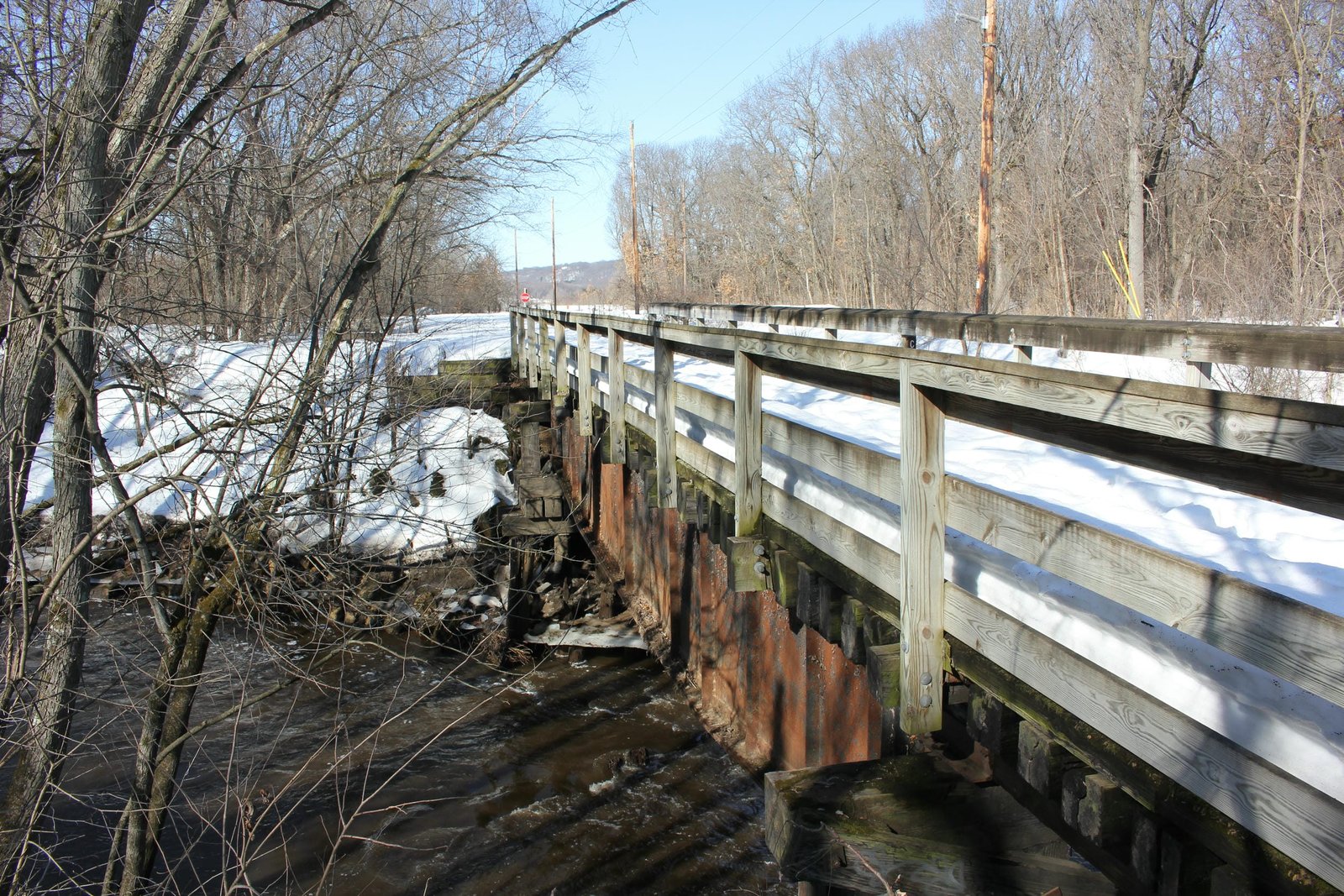
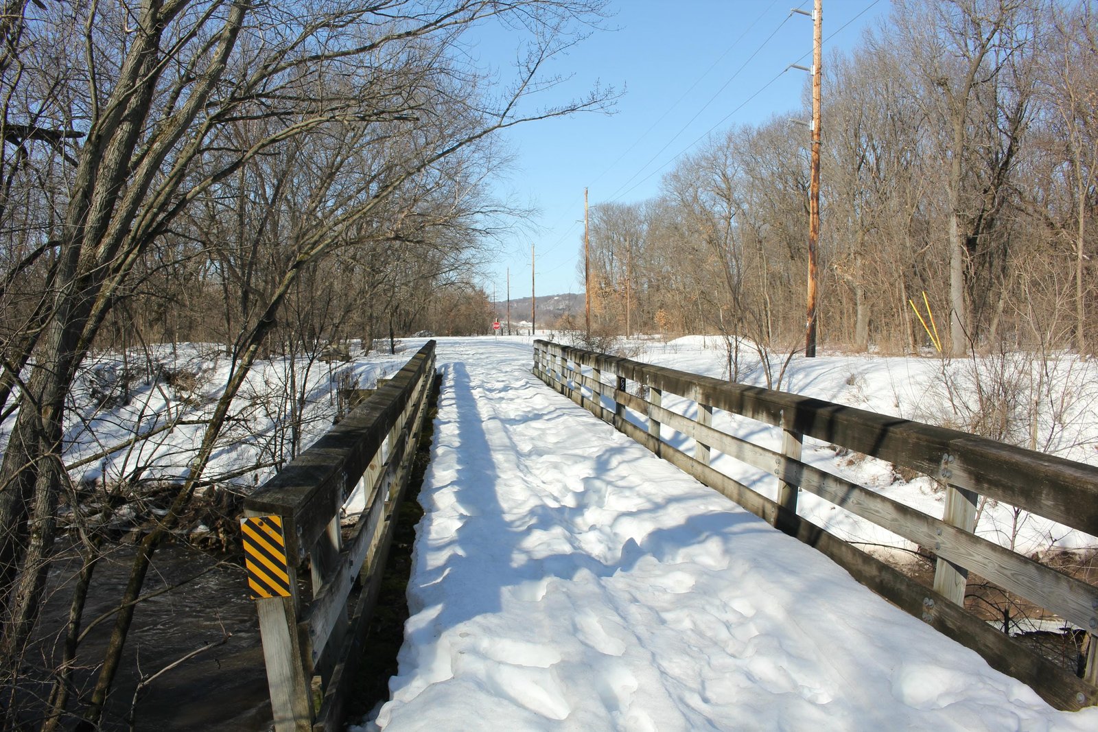
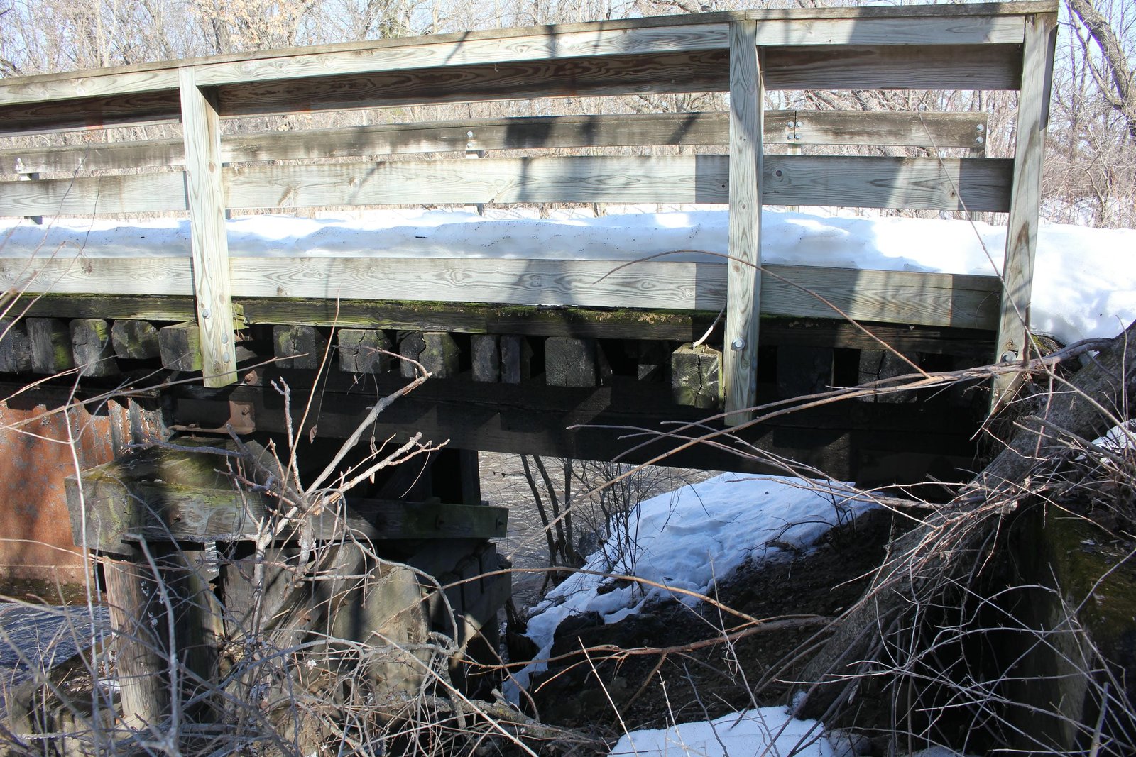
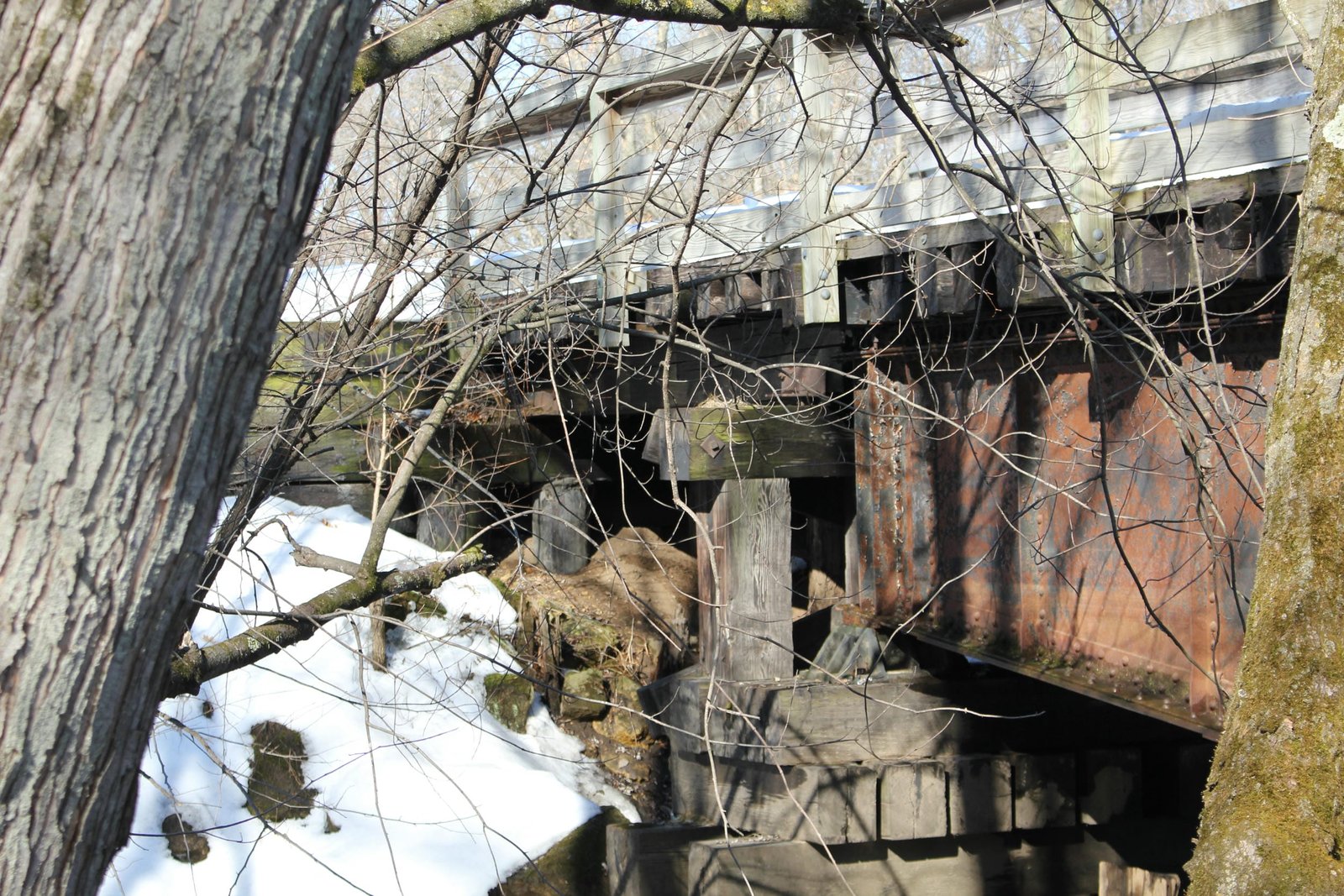
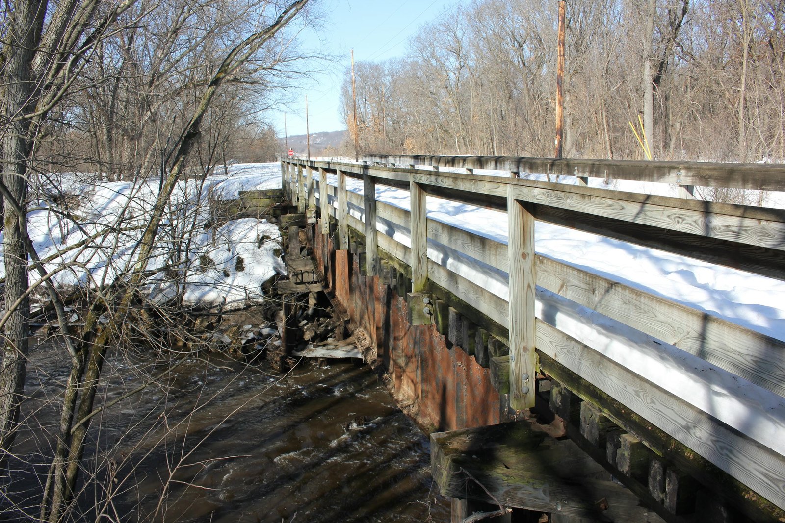
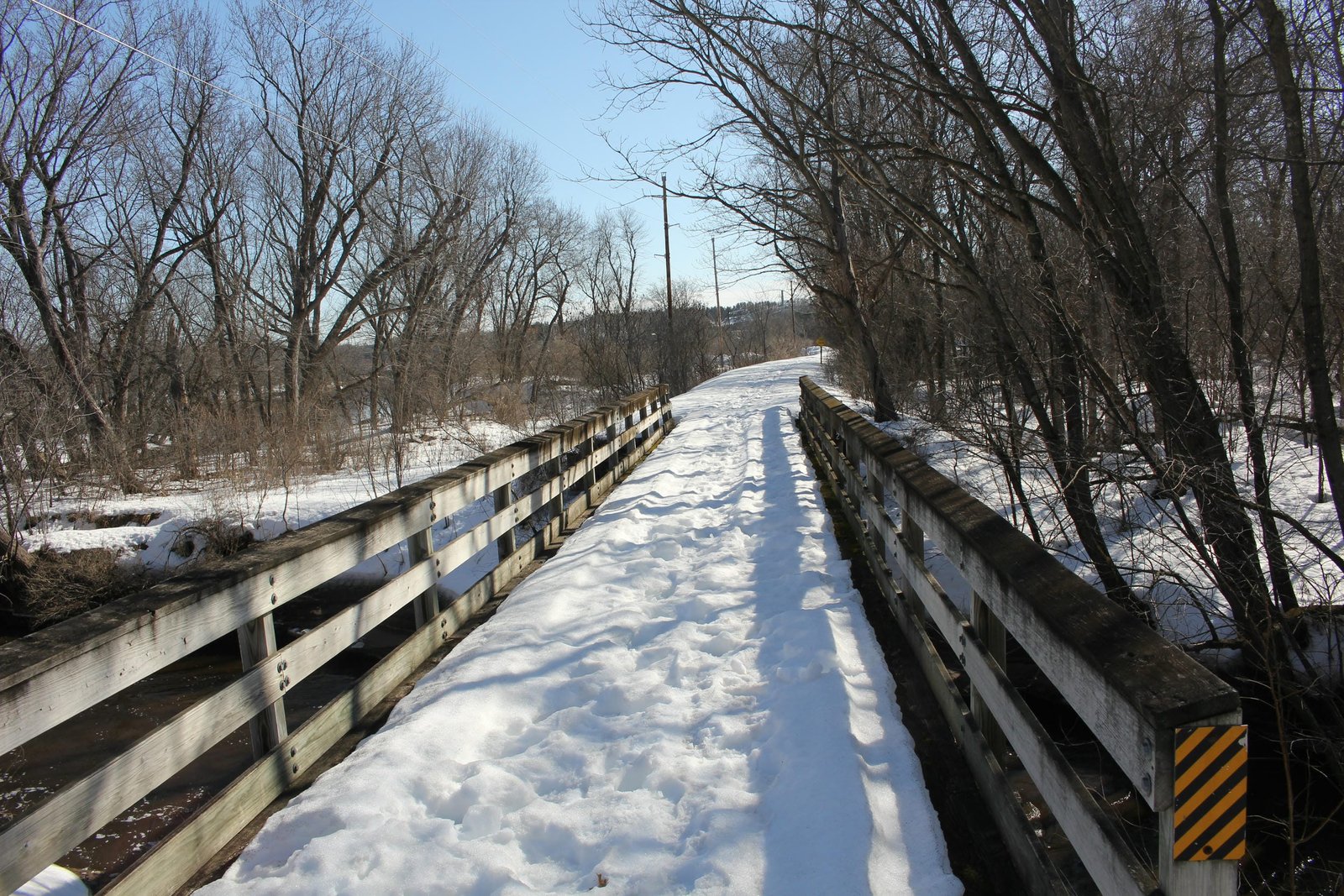
Located on the south side of Eau Claire, this bridge carries the former Chicago, Milwaukee, St. Paul & Pacific Railroad over Lowes Creek. The previous bridge at this location was a timber pile trestle bridge, which had periodically been updated since the line was first built. After the bridge was damaged by a flood in 1930, it was decided to replace the bridge with a steel span. Instead of purchasing a new span for use at this location, the Milwaukee Road opted to reuse a span which had recently been replaced on a mainline. Currently, the bridge consists of a 54-foot deck plate girder span, approached by a single timber pile trestle span on either end and set onto timber pile substructures. The span was originally fabricated by an unknown contractor in 1893 as part of a two span bridge across an overflow of Williams Creek at Bridge #I-824 near Mosby, Missouri. In 1930, the Milwaukee Road completed a realignment in that area, and the old bridge was removed. It was decided to combine the two spans into one double strength span, and install them here. Work to repair and strengthen the bridge was completed by the Vierling Steel Works. The girder span uses a standard design, with an open deck and heavy girders. The bottoms of the girders use a "fishbelly" or curved design, typical for locations with limited clearance underneath. Deck plate girder bridges were commonly used by railroads, as they were durable and easy to construct. Overall, the bridge appears to be in fair to good condition, with no significant deterioration noted. The bridge is now used as part of the Chippewa River State Trail, and is owned by the Wisconsin Department of Natural Resources. The author has ranked this bridge as being locally significant, due to the common design.
Citations
| Builder, build dates and relocation history | Milwaukee Road Bridge Index, located at the Milwaukee Road Archives at the Milwaukee Public Library |
| Railroad History Citation | ICC Valuation Information, Compiled by Richard S. Steele |