


Click the photo to view the full-size version
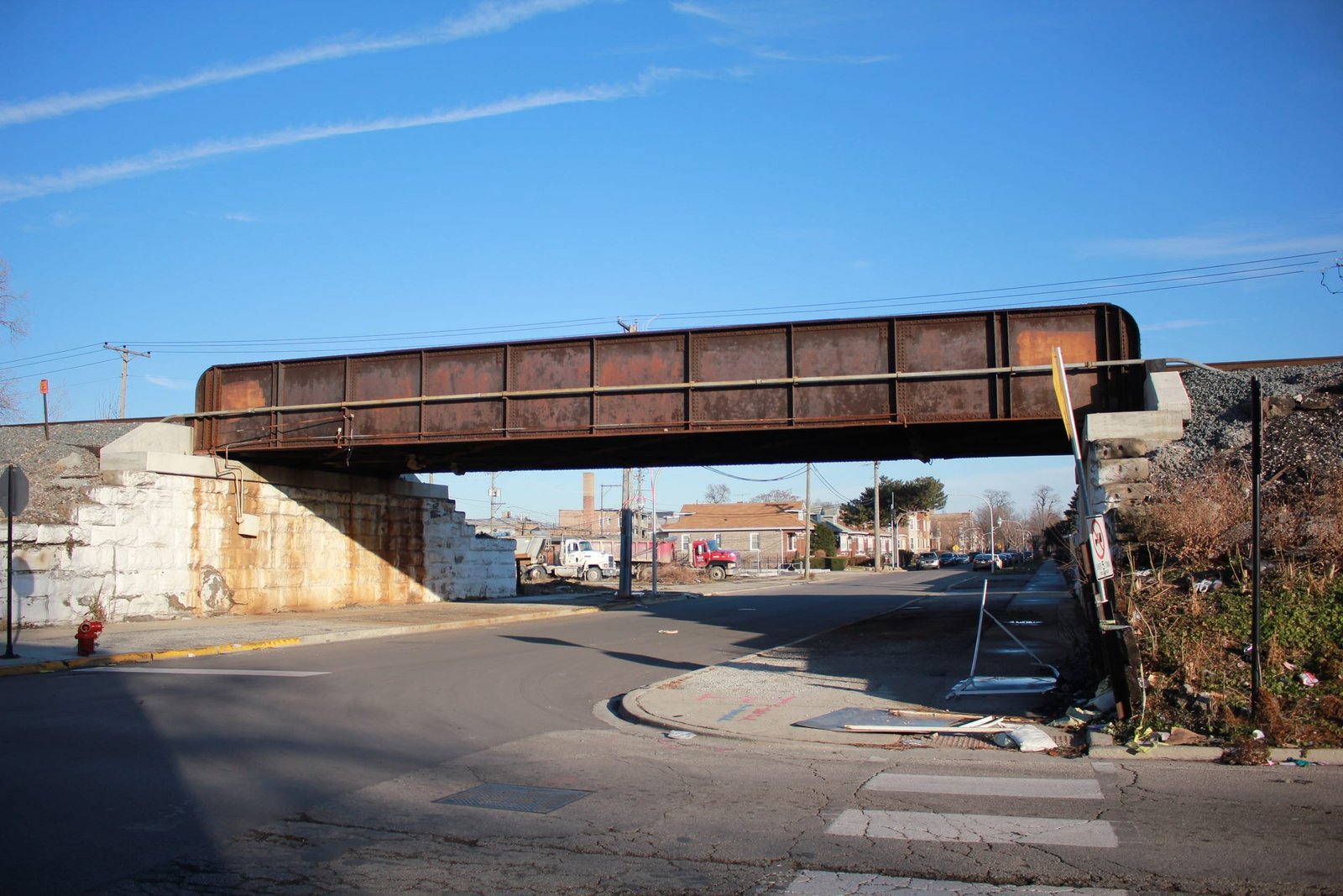
| Name | BRC Monroe Street Bridge |
| Built By | Belt Railway of Chicago |
| Currently Owned By | Belt Railway of Chicago |
| Contractors | Unknown |
| Length | 72 Feet Total |
| Width | 2 Tracks |
| Height Above Ground | 13 Feet 2 Inches |
| Superstructure Design | Through Plate Girder |
| Substructure Design | Concrete and Stone Masonry |
| Date Built | c. 1900 |
| Traffic Count | 50 Trains/Day (Estimated) |
| Current Status | In Use |
| Significance | Local Significance |
| Documentation Date | 12/16/2018 |
In 1882, the Belt Railway Company of Chicago (BRC) began building lines connecting major railroads on the south and west sides of Chicago. The route was selected to go through portions of South Chicago as well
as Cicero. Five railroads originally financed the project, although
nine additional owners would join in 1910. A subsidiary of the Chicago & Western Indiana Railway, the railroad
started near the Calumet River mouth at Lake Michigan, and proceeded
westwards between 91st and 94th Streets until Auburn Park. From Auburn Park, the route followed the C&WI for a short distance, before heading west along 75th Street. Near Cicero Avenue in Hayford, the main line turned north along Cicero Avenue, until it reached the Milwaukee Road at Cragin. A large yard would be built near Hayford, which would become the main facilities of the railroad. The entire route would be constructed with at leasttwo tracks.
In the late 19th Century, railroad traffic had become a significant
safety hazard for the City of Chicago. A solution was devised to
elevate the railroad tracks throughout the city, placing the railroads
upon embankments and constructing subways at each street. Much of the BRC line would be elevated in the early 20th Century. During the 20th Century, the railroad remained a critical component of the Chicago railroad network, connecting several large railroad yards with the main hump yard at Hayford. The railroad primarily operated by transferring cars between railroads. Today, the BRC continues to operate the same route, and the Clearing Yard continues to be among the largest railroad yards in the United States.
Located between the Austin and West Garfield Park neighborhoods of Chicago, this bridge carries the Belt Railway of Chicago Kenton Avenue Line across Monroe Street. In the late 19th Century, the numerous grade crossings throughout the City of Chicago posed a serious hazard to the general public. Overpasses, which carried roads over the railroads, were expensive and detrimental to the surrounding properties. By the late 1890s, the railroads began to work with the city to elevate segments of track through the city, placing subways at street crossings. An ordinance was passed on April 6, 1898 requiring the elevation of the Belt Railway of Chicago between Adams Street and Kinzie Street. The work was completed in approximately 1900. The bridge at Monroe Street utilizes a 72-foot through plate girder span, set onto concrete and stone abutments. The girder utilizes a traditional design, including a open deck, heavy floor and rounded ends. Open decks were used on some early track elevations in Chicago, but quickly lost favor in the early 20th Century. This design of bridge was commonly used by railroads throughout the United States, as it was durable and easy to construct. Overall, the bridge appears to be in fair condition, with no major deterioration noted. The author has ranked the bridge as being locally significant, due to the common design.
Citations
| Railroad History Citation | ICC Valuation Information, Compiled by Richard S. Steele |