logo

Maxwell Trail Bridge

Concrete Arch Bridge over Rock Creek
Maxwell, Story County, Iowa

Click the Photo Above to See All Photos of This Bridge!
Name Maxwell Trail Bridge
Built By Chicago, Milwaukee & St. Paul Railway
Contractor Unknown
Currently Owned By Iowa DNR
Length 50 Feet Total
Width 2 Tracks
Height Above Ground 25 Feet (Estimated)
Superstructure Type Concrete Arch
Substructure Type Concrete
Date Built 1913
Traffic Count 0 Trains/Day (Bridge is a Trail)
Current Status Rails to Trails
MILW Bridge Number Z-1068
Significance Moderate Significance
Documentation Date December 2016
In 1870, the Sabula, Ackley & Dakota Railroad built a line from Sabula, Iowa to Marion, Iowa; a distance of 87 miles.
This railroad became part of the Chicago, Milwaukee & St. Paul in 1872. The CM&StP (Milwaukee Road) had already constructed a line from Sabula, to Chicago.

By 1881, the Milwaukee Road continued to build west. A new line would be constructed through towns such as Toledo, Huxley, Madrid and Perry.
In 1882, the railroad continued to build west through more towns, such as Coon Rapids, Manning and Neola.
By the end of 1882, the railroad finally reached Council Bluffs.

Although the long mainline was completed, it had many issues. Bridges were not built to standard, curves were an issue; and specifically in the western part of Iowa, grades were atrocious.

Chief Engineer Charles Loweth began to address the problems in 1912. Fresh off of the Pacific Expansion, a veteran team helped redesign two mainlines: Minnesota and Iowa.
The expansion also added the "Pacific" to the title, creating the CMStP&P.
While the Minnesota line presented a fairly straightforward situation, the Iowa line presented more challenges.

The eastern portion of the state was simple, with slight grade and route changes. However, the western portion of the state required many route changes, grade reductions and large bridges.
272 Miles would be completed by 1914, between Green Island, Iowa and Manilla, Iowa. This line featured sleek curves, reduced grades and a top class double track line.
In addition, the remaining track between Manilla and Council Bluffs would also be improved.

However, these expansions quickly were realized as too ambitious. Significant portions of the double track were pulled up. Sections included:
Templeton to Herndon and Newhall to Collins were reduced to single track in 1934. Paralta to Green Island was reduced in 1950, and Madrid to Collins in 1956.

Despite a fairly solid traffic base, the Milwaukee Road was oftentimes in trouble financially. At this point, a mass abandonment was court ordered for the Milwaukee Road. 791 miles in Iowa would be abandoned, including the entire Council Bluffs line.
However, some sections were kept intact. Burlington Northern purchased the line from Council Bluffs to Bayard. This is now the BNSF Bayard Subdivision. BNSF was formed from a merger of the Atchison, Topeka & Santa Fe and Burlington Northern in 1996.
In addition, Chicago & North Western was sold the line from Woodward to Slater, and from Herndon to Perry.
C&NW became part of Union Pacific in 1995. In 2003, the Woodward section was abandoned. In 2004, the Perry to Dawson section was abandoned. The Herndon section was abandoned in 1999.

In addition to the Bayard Subdivision, the Raccoon River Valley Trail and High Trestle Trail also utilize portions of this line.
08/24/21


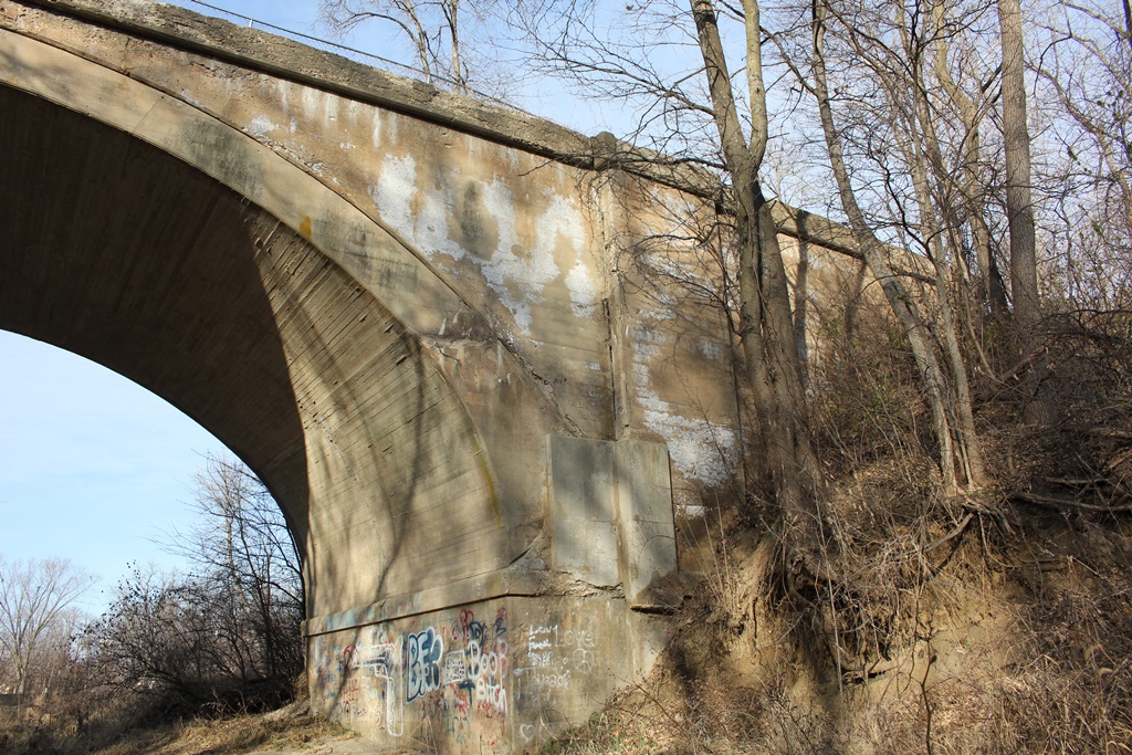
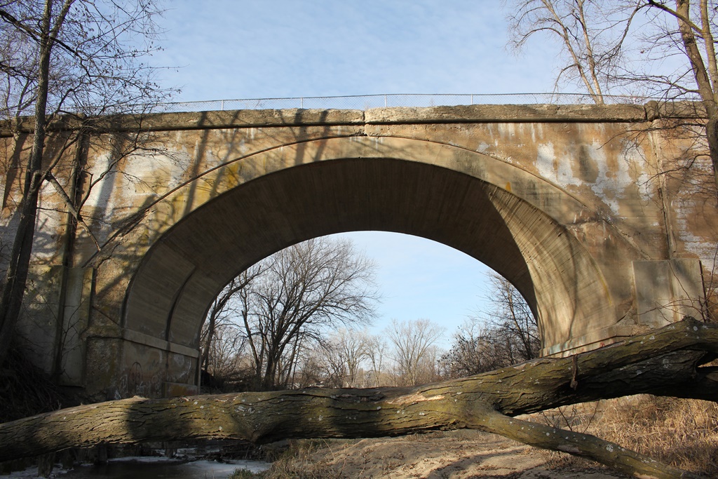
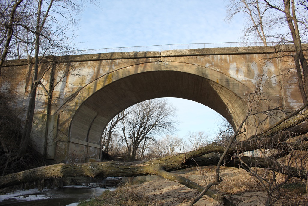
While the nearby Hoy Bridge is the most well known structure along the Heart of Iowa Nature Trail, this structure is equally as significant.
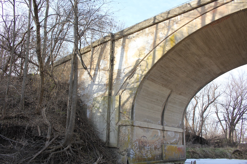
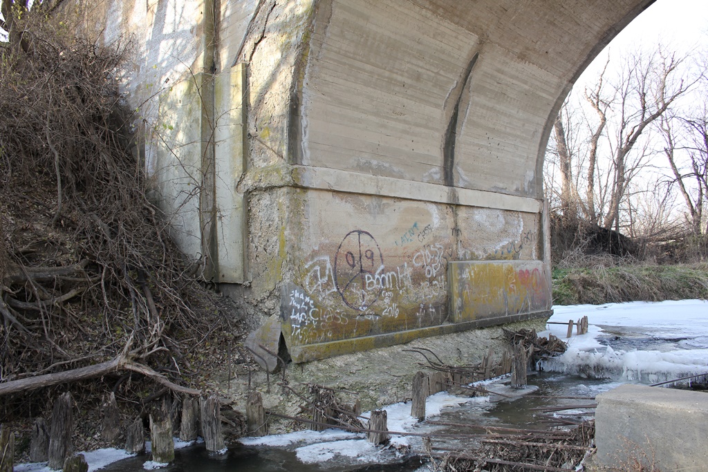
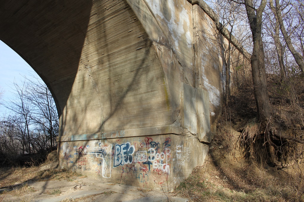
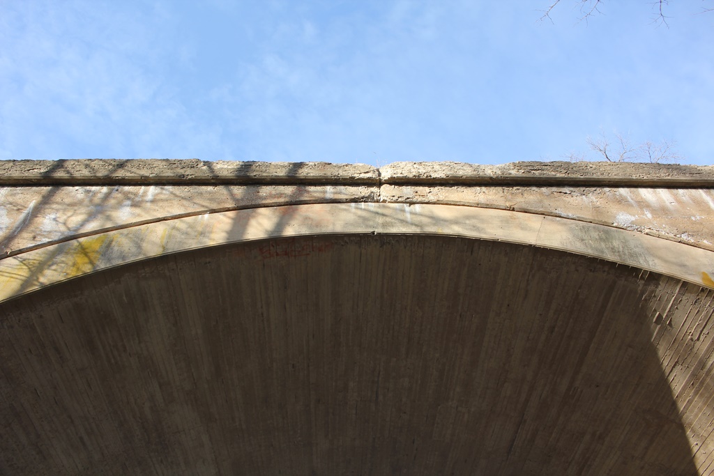
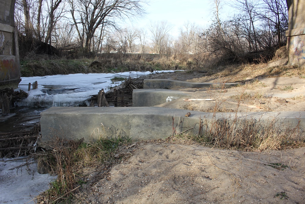
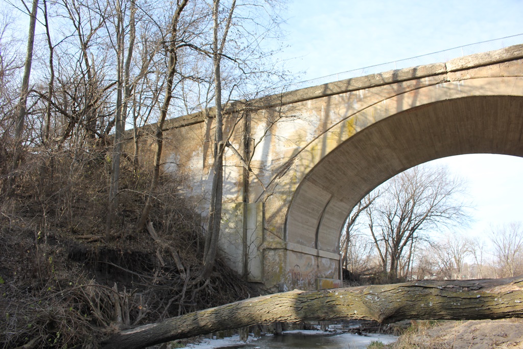
Crossing Rock Creek in Cambridge many feet above the water, this simple closed-spandrel arch was built in 1913. While many other arches sport the closed-spandrel design, this is one of the largest.
The previous bridge at this location was likely a wooden trestle. This design was built during a double tracking project.

Construction of bridge
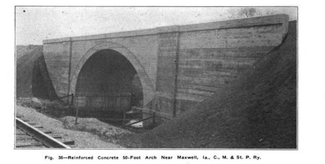
Photo of construction from Railway Review: Volume 54 (digitalized by Google)

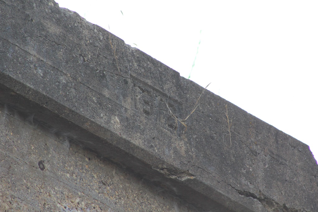
While appearing frail, the bridge actually remains in rather good condition with some minor spalling.

The author has ranked the bridge as being moderately significant due to the unique large span and the limited amounts of large concrete arches in the area.
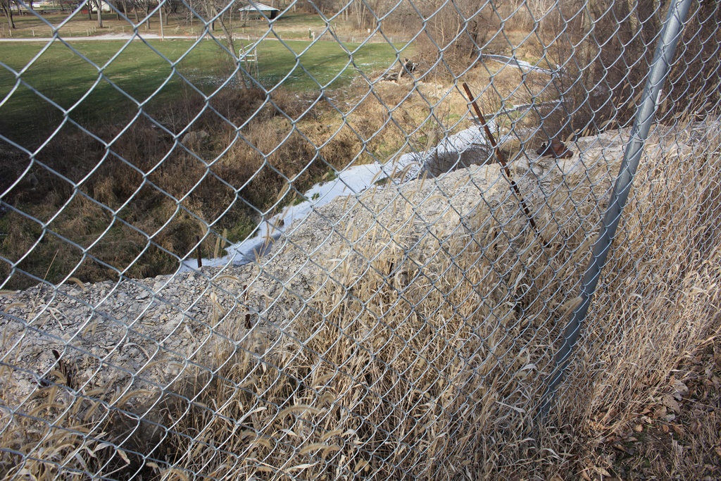
The photo above is an overview. The bridge can be accessed from a nearby park.

Citations

Source Type

Source

Build Date Date Stamp
Railroad Line History Source ICC Valuation Information, Compiled by Richard S. Steele


Widget is loading comments...


© Copyright 2010- John Marvig and Contributors. All Rights Reserved