
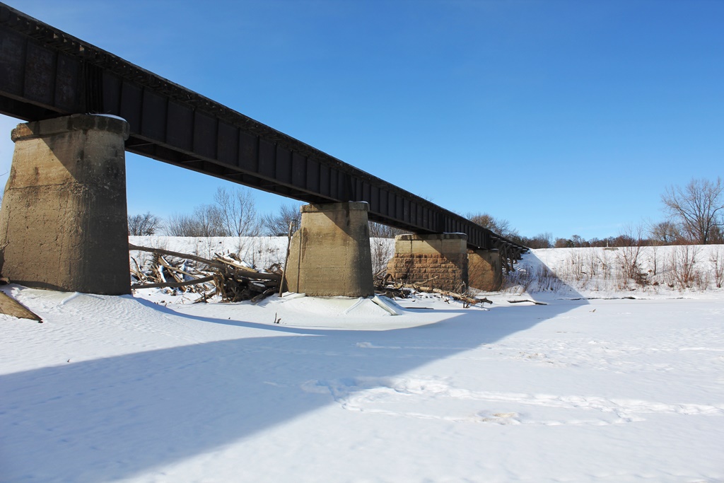
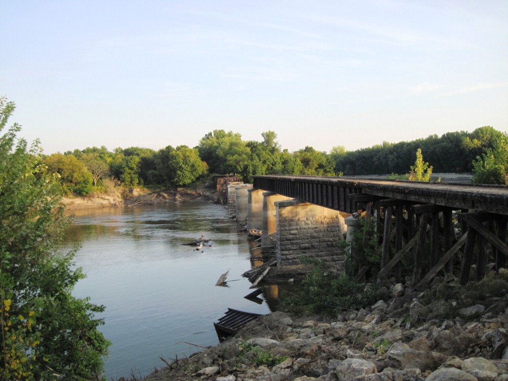
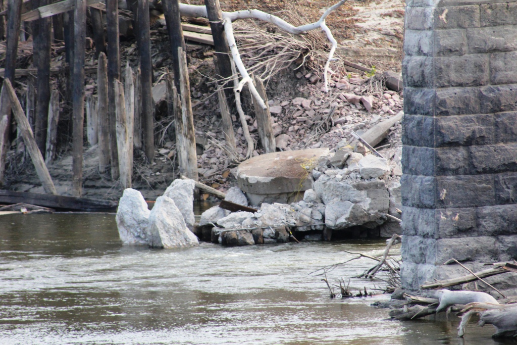
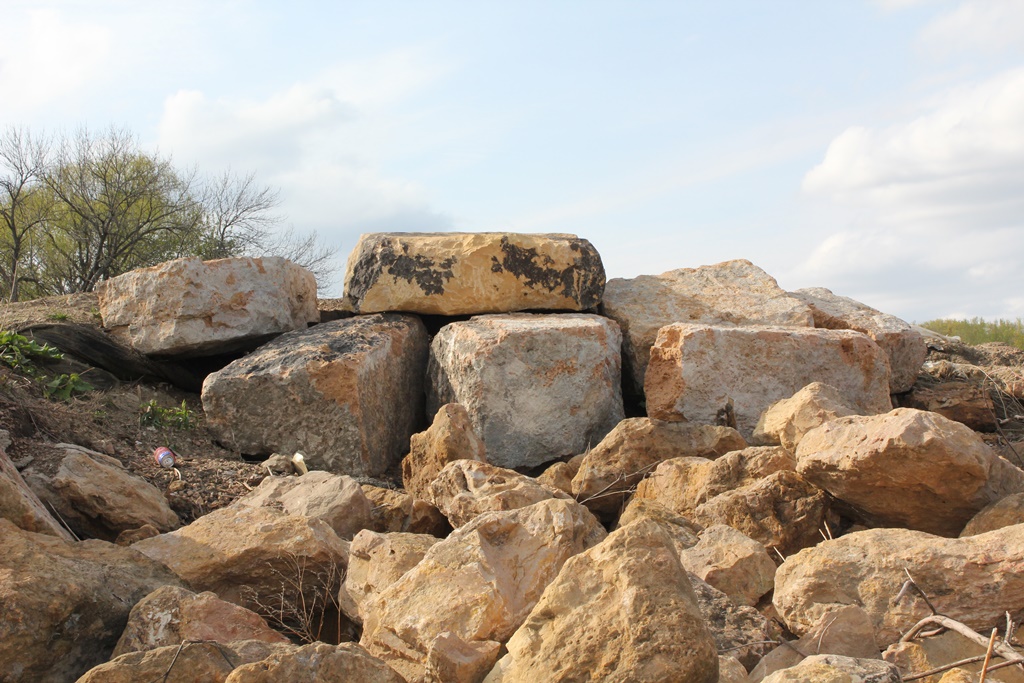
Once the landmark bridge of the small river town of Carver, only a few blocks of stone and concrete remain of this large structure.
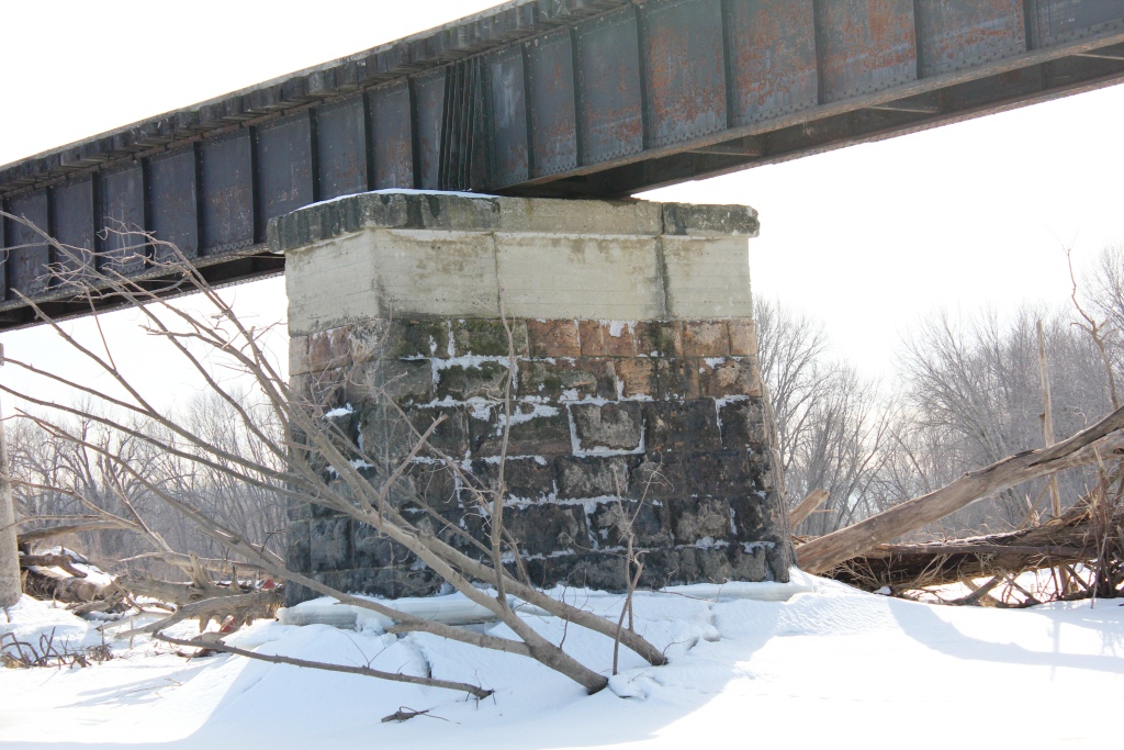
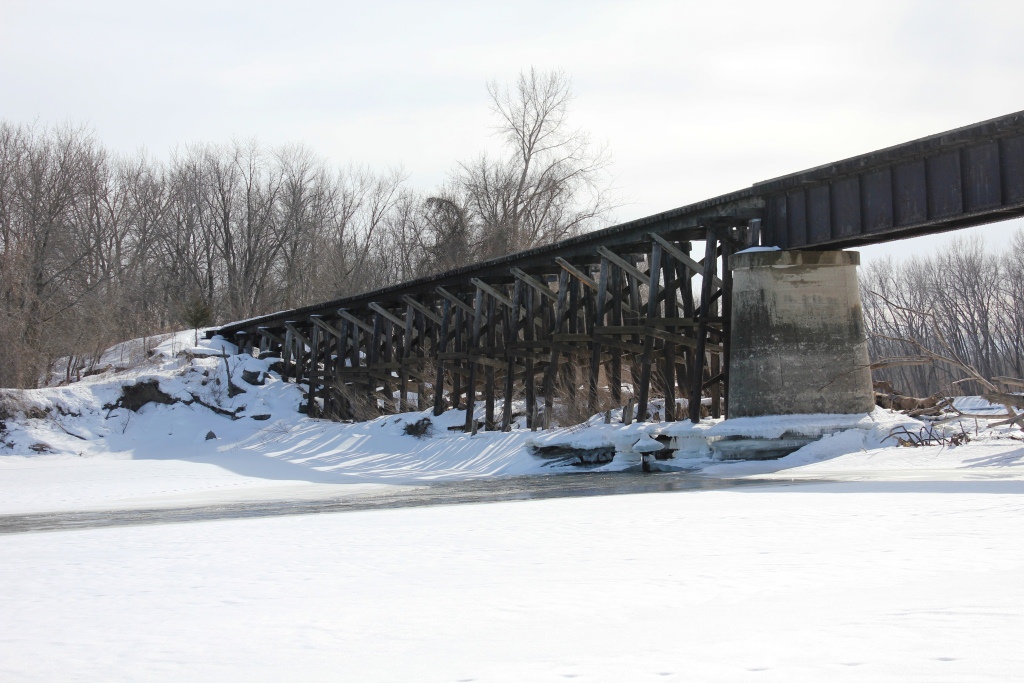
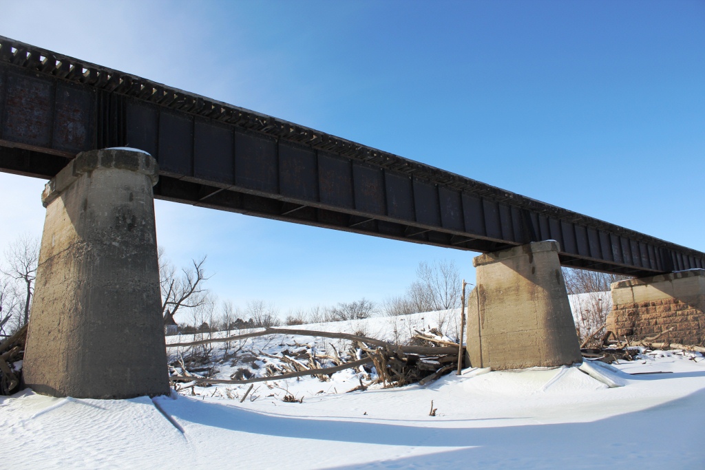
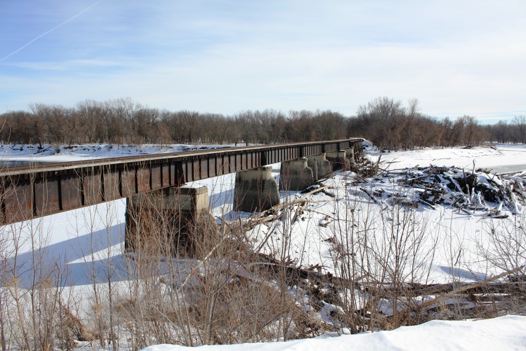
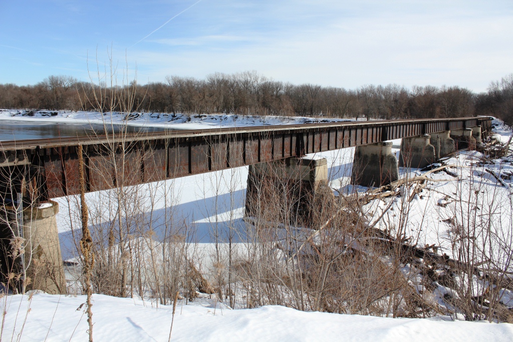
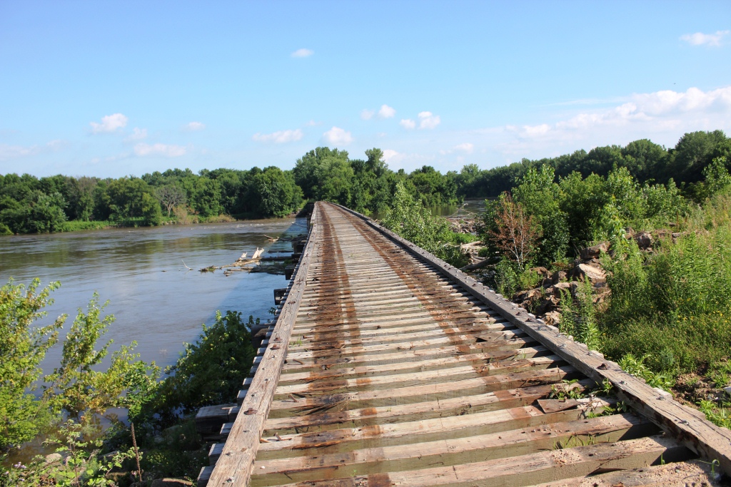
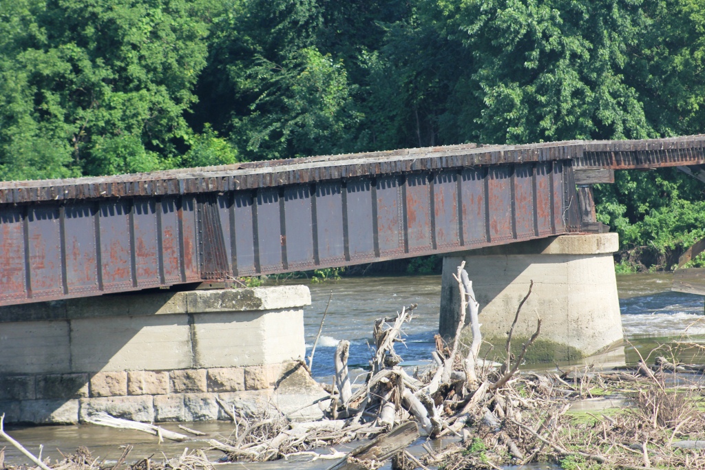
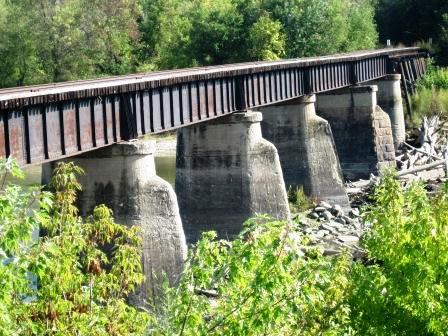
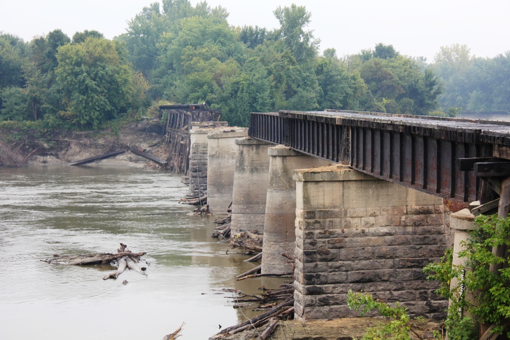
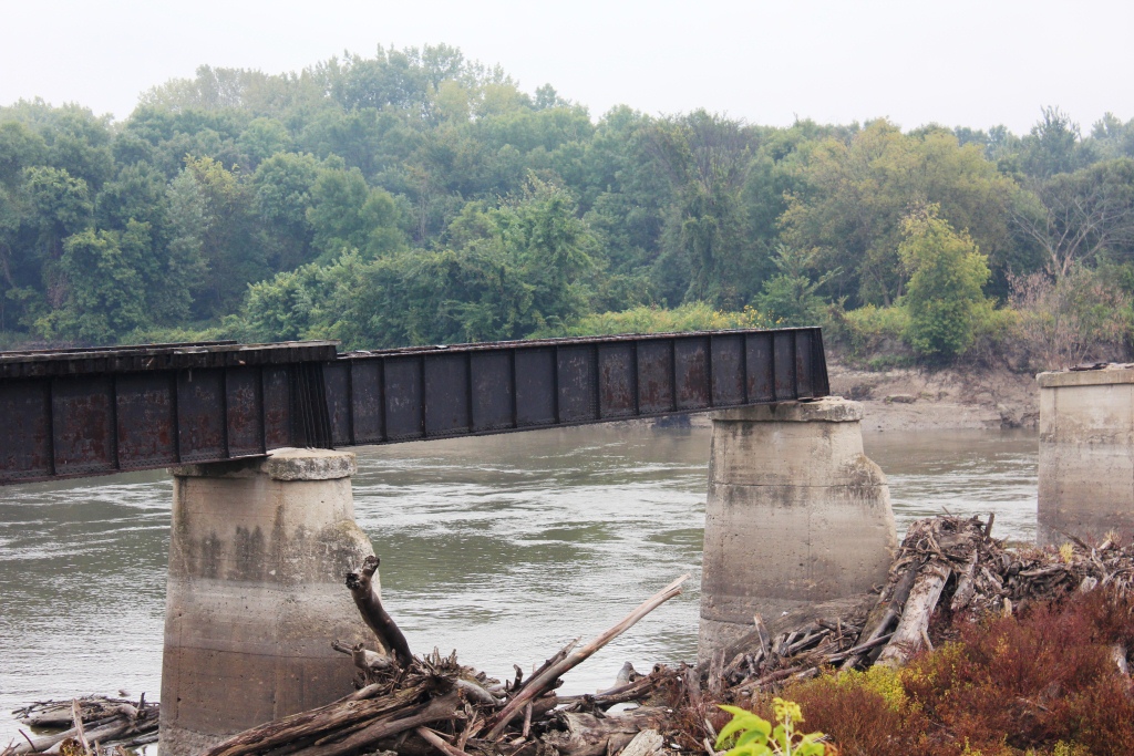
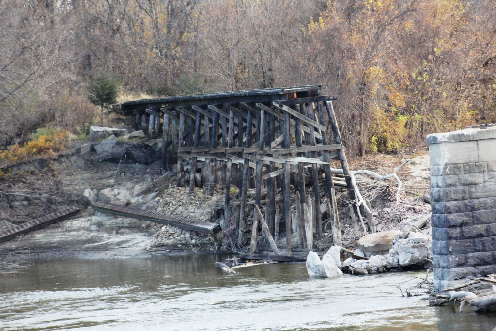
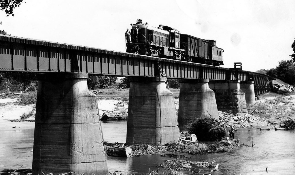
Rivaled by only a few bridges along the Minneapolis & St. Louis Railway system, this large structure consisted of six deck girder spans, resting on concrete and stone piers.
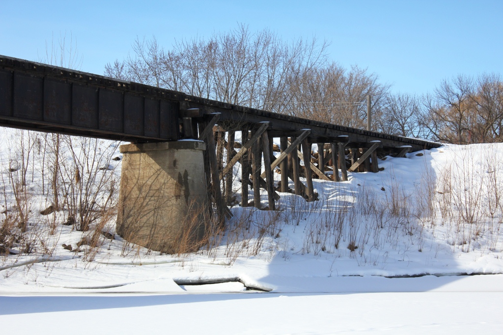
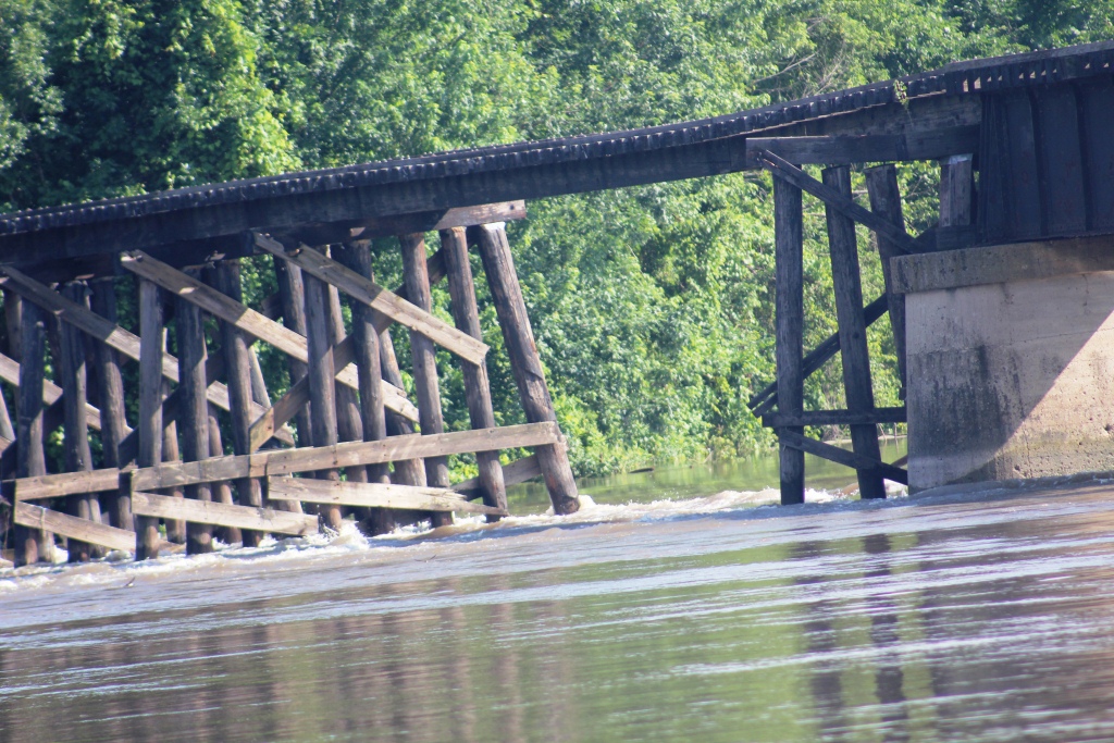
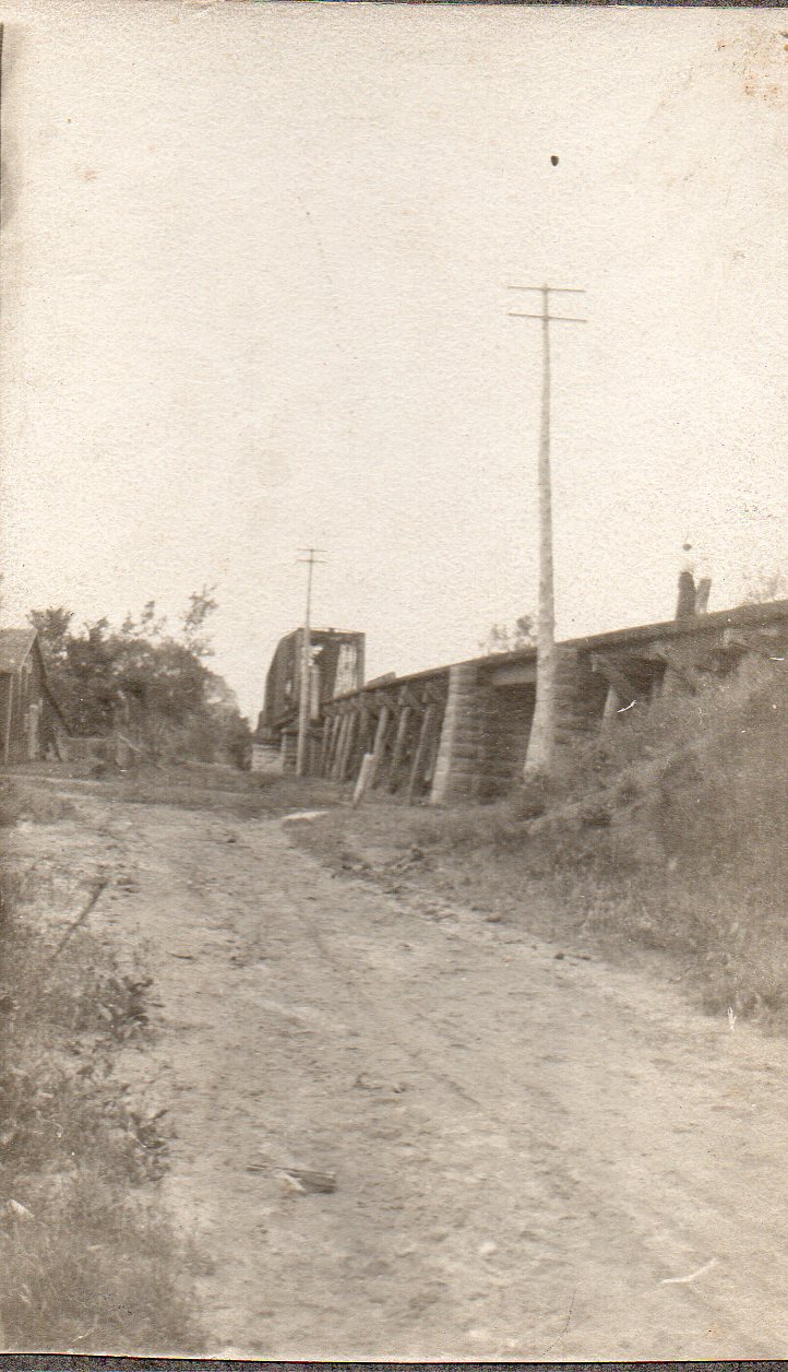
Originally, the first bridge here was a wooden truss type structure with a swing span to allow steamboats to pass upstream. The remainder of the bridge was constructed of wooden trestle spans, with the exception of a short I-Beam span on the north approach of the bridge.
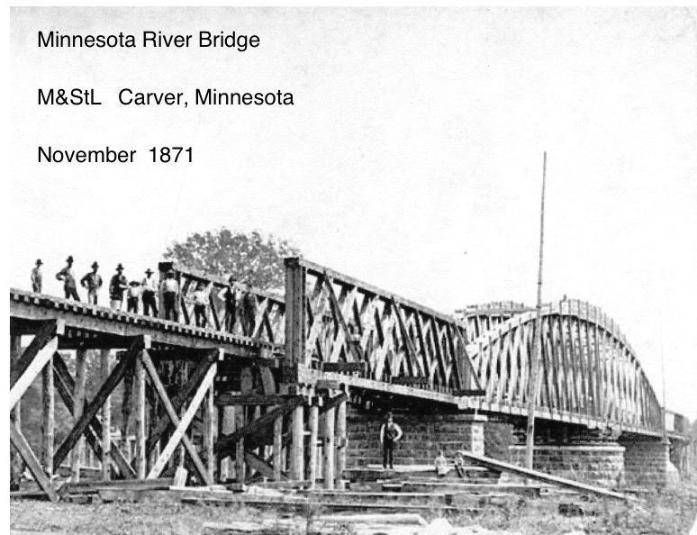
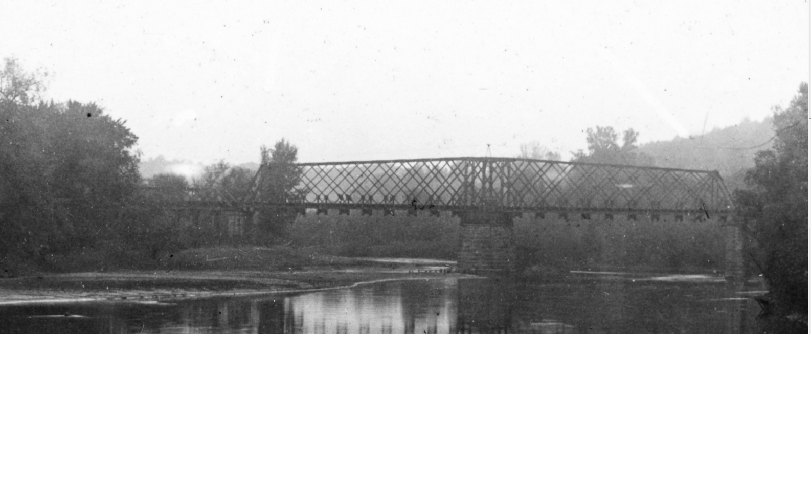
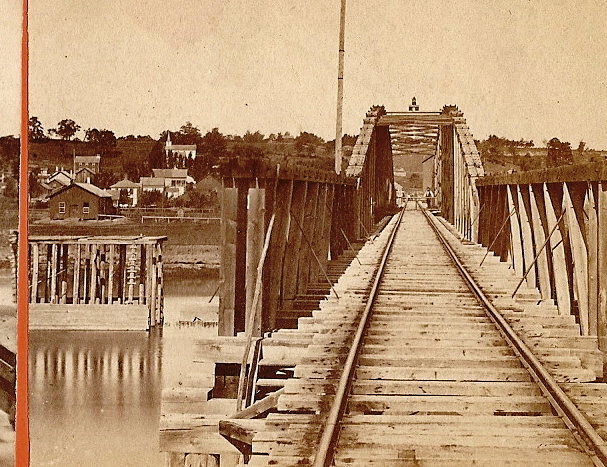
When that bridge became too deteriorated for traffic, it was replaced with a iron type swing bridge in 1889. This swing bridge included a Lattice Through Truss design, and pony truss approaches along with the trestle approaches on either side.
However, this structure deteriorated quickly. According to some sources, it is believed that the center "swing" pier was being undercut by the bend in the river, a similar issue that happened approximately 80 years later in Chaska.
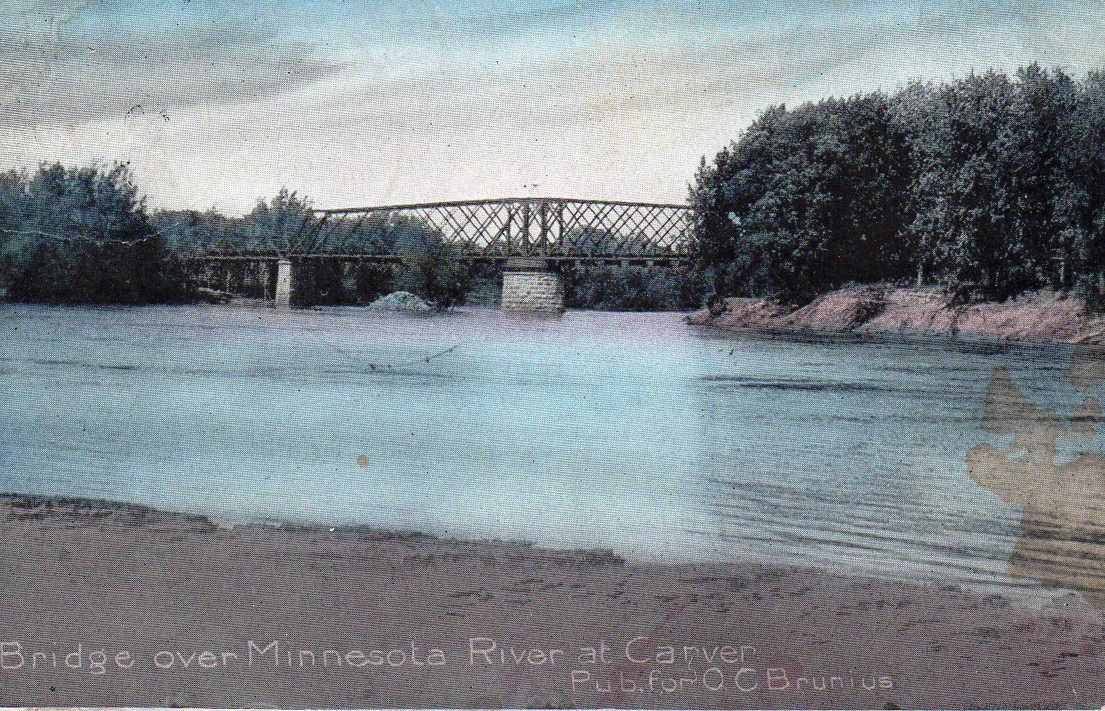
Due to the terrain of the Minnesota River, the riverbed is composed mainly of mud and silt, unlike some rocky bottom rivers in the area. This could have easily caused large piers to fail prematurely. When the second bridge was replaced, the two pony truss spans were reused as highway overpasses. One was confirmed to have been sent to Victoria, Minnesota on Stieger Lake Lane, where it survived from 1923 until 2003.
In 1916, proposals were made to build a new structure at this location. World War I was raging in Europe, and a quick fix for the deteriorated truss bridge was needed.
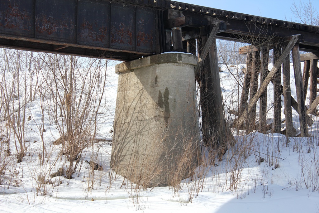
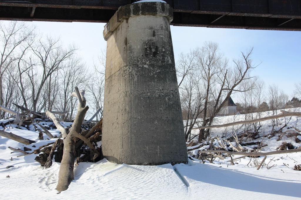
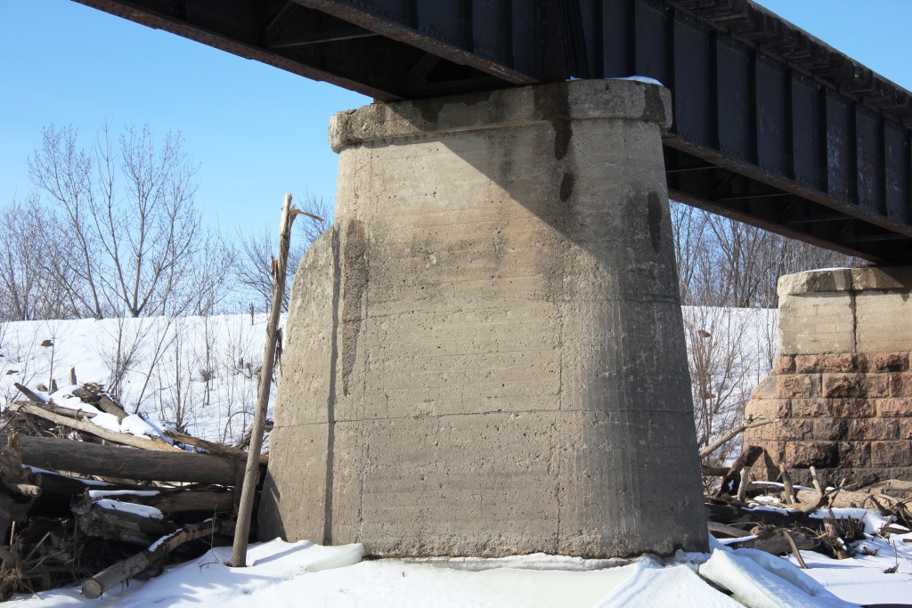
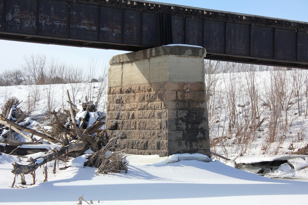
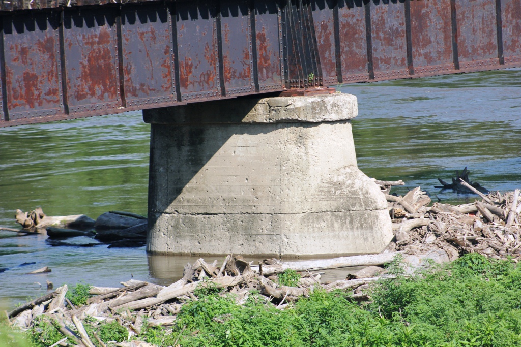
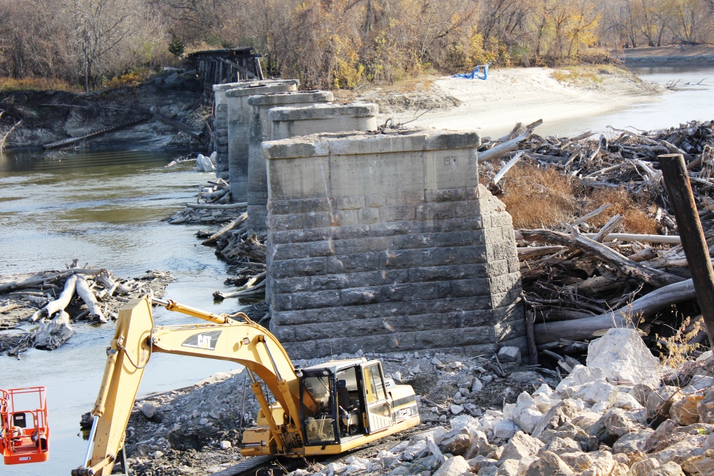
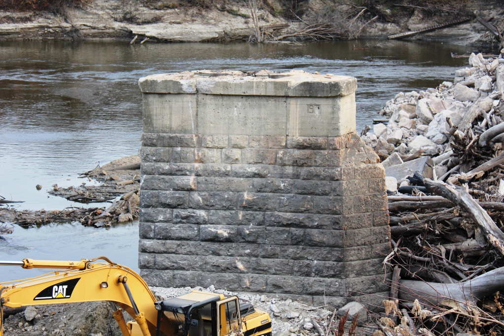
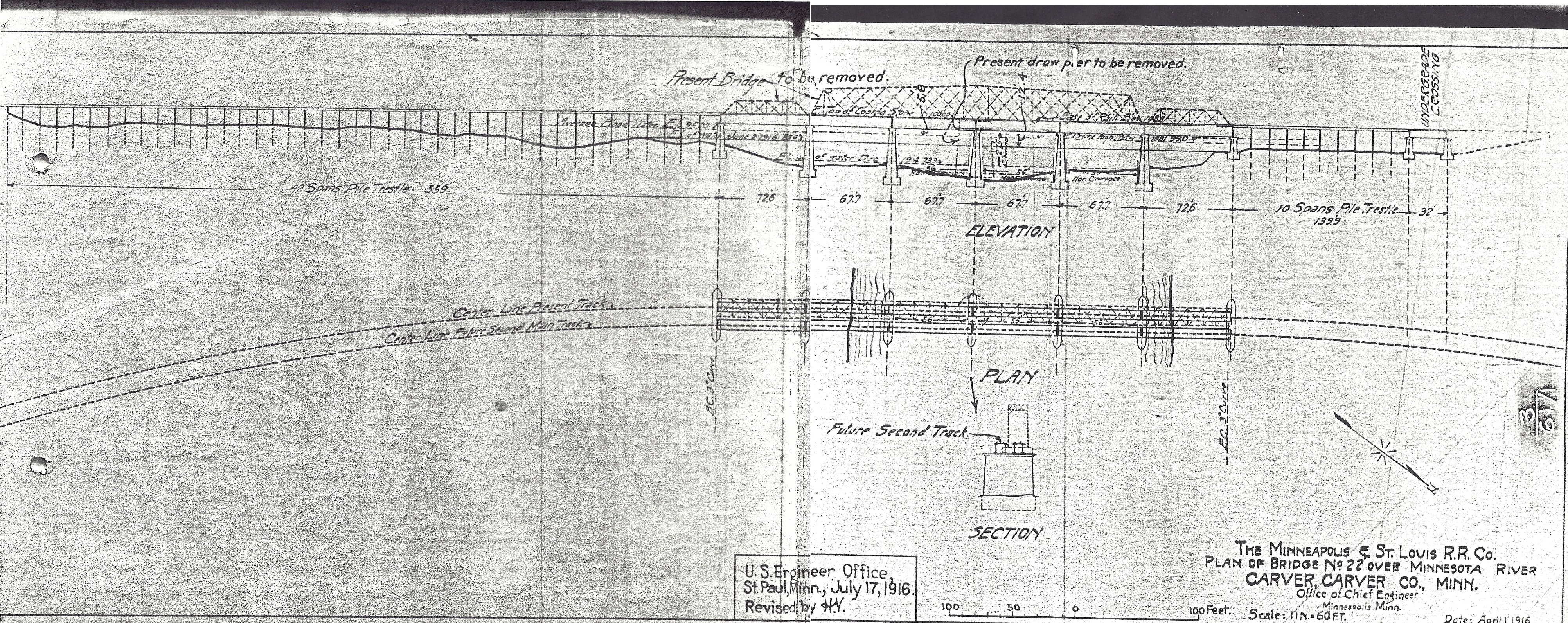
What was constructed was a six span deck girder structure, set onto concrete and stone piers. The original swing pier was removed to the water level. Five new concrete piers were constructed, and the other two were capped with concrete. The entire bridge was to be raised five feet eight inches to accommodate a higher capacity of water.
The deck girder spans chosen for the bridge were designed to save money, not carry heavy traffic. As a result, the bracing between the girder lines was about half as thick as it should have been. Bolts were also very thin, and the sheer forces when a train crossed gradually wore down the fasteners inside.
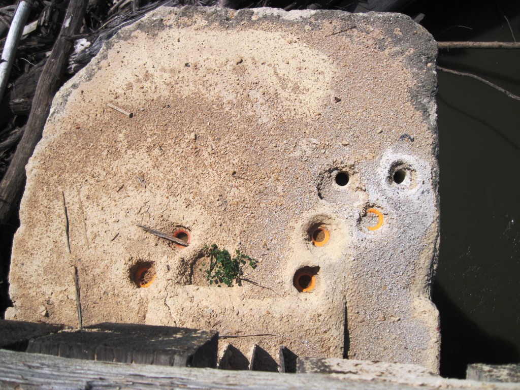
Another issue was presented during the construction of the new bridge. Several tons of steel reinforcing bars, known as rebar were stolen from the site. These reinforcements were intended to create a cage structure for the new concrete piers.
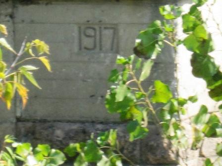
Because of the theft of the rebar, no rebar was ever used in construction, a very odd choice for 1917 when rebar was considered to be an engineering industry best practice.
Once the bridge was completed, the railroad was handed a flawed structure that it immediately considered to be temporary. The chief engineer of the project was fired soon after completion of the bridge.
However, the two remaining stone piers were capped with concrete, with the intention of making a second track. Blueprints for the final bridge show a future second track was planned.
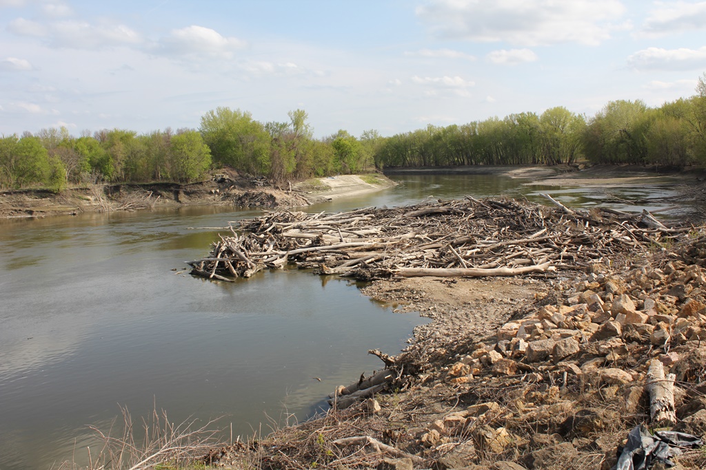
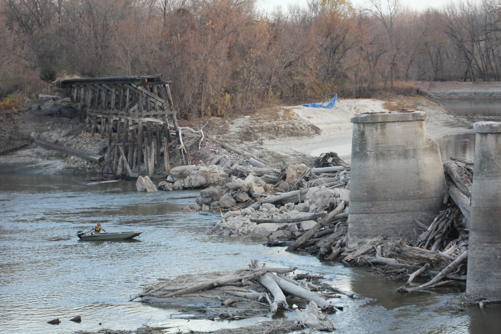
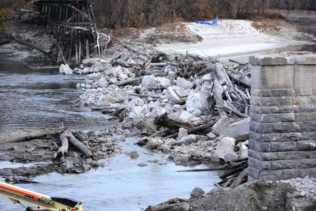
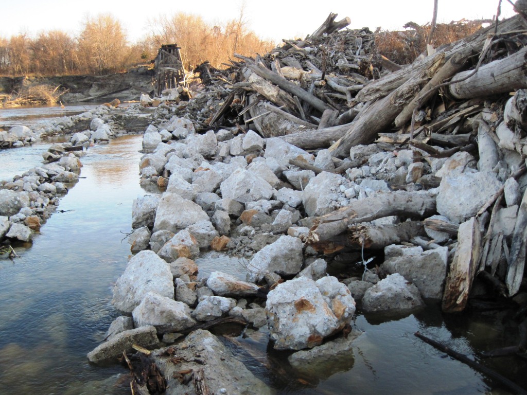
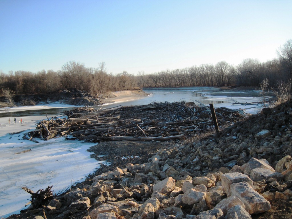
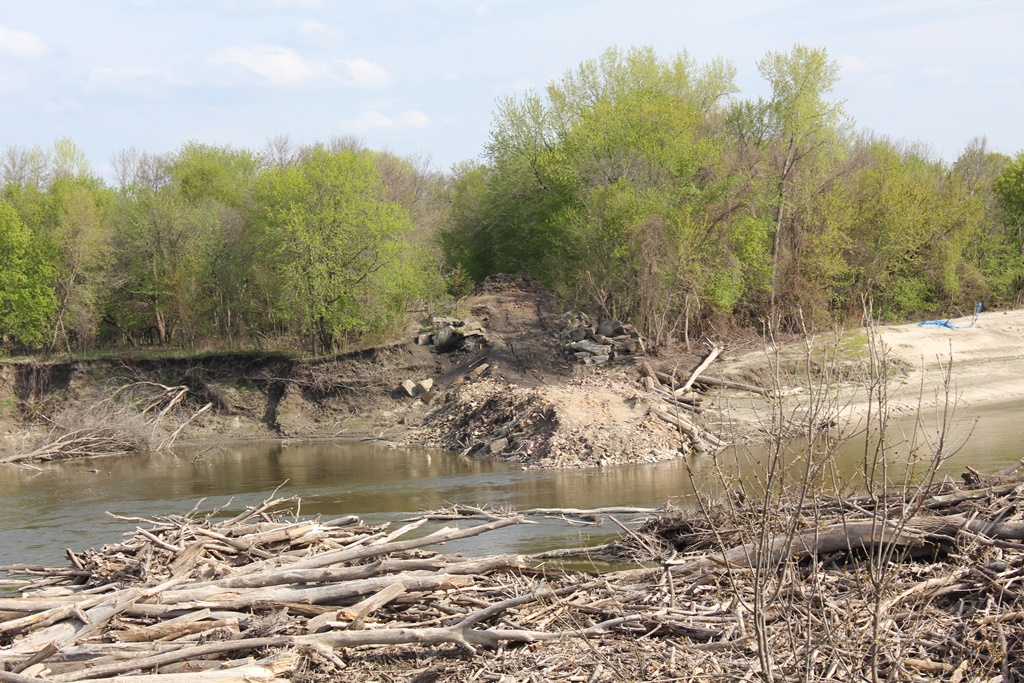
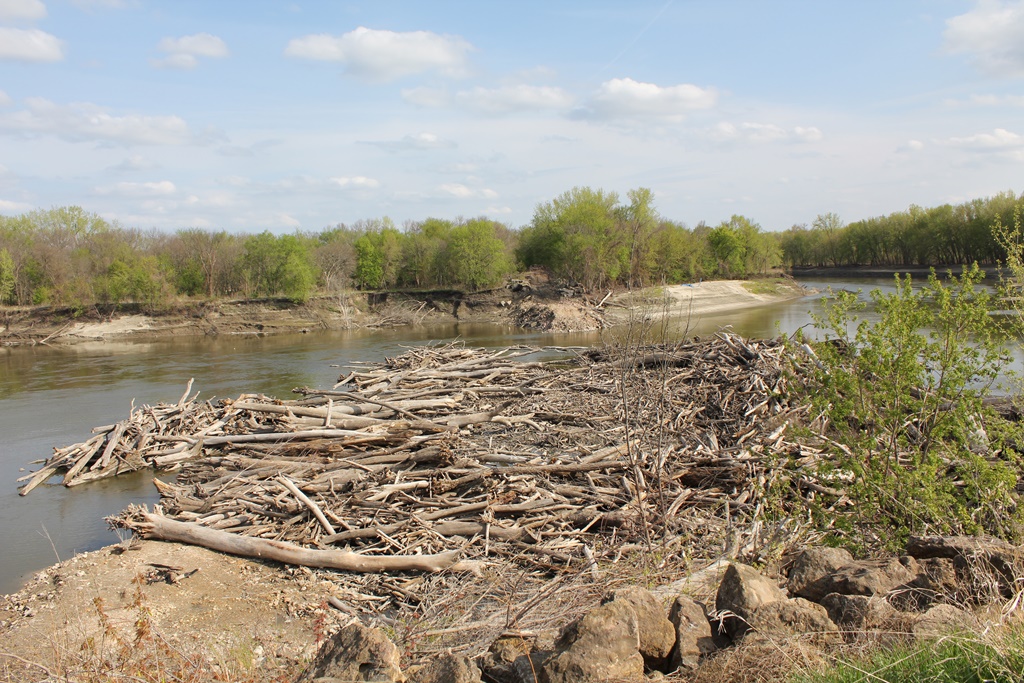
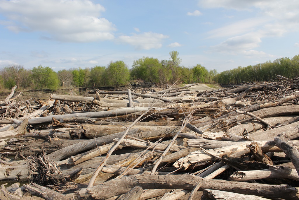
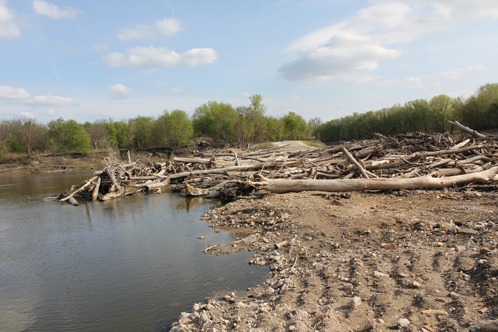
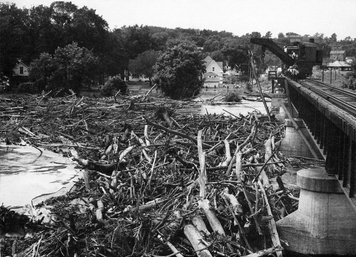
The flaws did not come to life until the 1920s and 1930s. Due to the large bend on the river at this location, and the short spacing of the piers; debris would oftentimes get hung up at this location, creating massive log jams that plagued the bridge until the end.
While the M&StL did a good job at taking care of the log jam problem, the successors of this line did not. At the time of demolition, the log jam was actually higher than the bridge.
By the 1920s, the "temporary" structure was envisioned for replacement with a large double track structure. This new double track bridge was to consist of a series of truss spans, and a large vertical lift span.
A double track structure was requested, mainly due to the inability for the railroad to compete with the parallel Rock Island route. The core of the traffic for the M&StL was agricultural customers in Iowa, and a double track structure would have alleviated capacity issues.
However, before the planning of the new bridge could be completed, the railroad entered serious financial issues, stemming from mismanagement during the 1920s.
Standing proud, the temporary bridge was now the permanent structure at this location. At times, it could carry more than 15 trains per day.
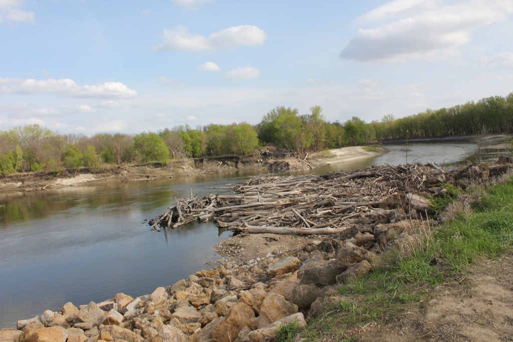
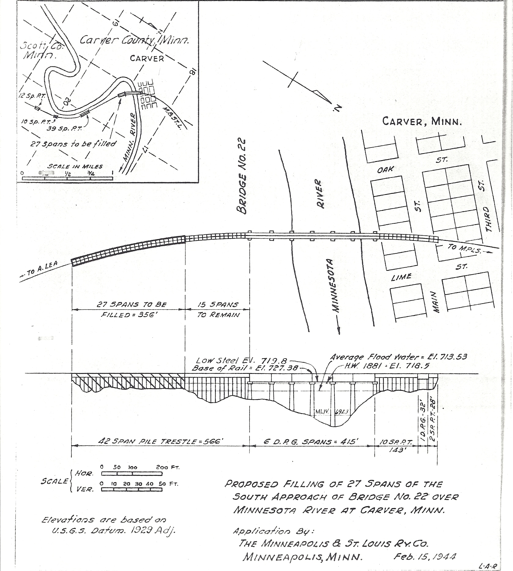
In the early 1990s, the north approach was filled in as a flood control measure. The Minnesota River bridge was effectively separated from what became the Main Street Bridge. However, both bridges were scheduled for demolition.
The Chicago & North Western, and later the Union Pacific Railroad never did much maintenance to the structure. The only visible maintenance was the regrouting of the stone piers in approximately 1985.
After the collapse of a trestle about a mile to the south of this bridge in 2007, it became apparent that Union Pacific had no intentions of rebuilding the small trestle.
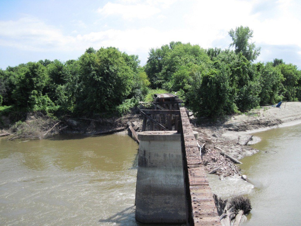
As a result, the bridge sat abandoned until 2010, when a deal was struck with Carver and Scott Counties to take ownership of the route, and remove the Minnesota River Bridge.
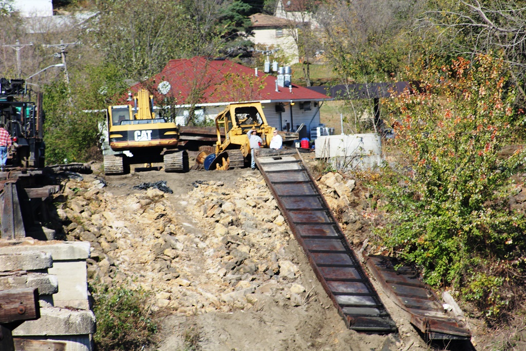
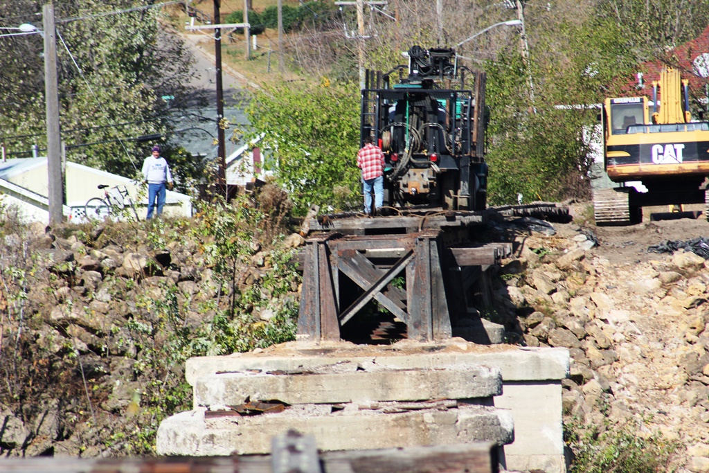
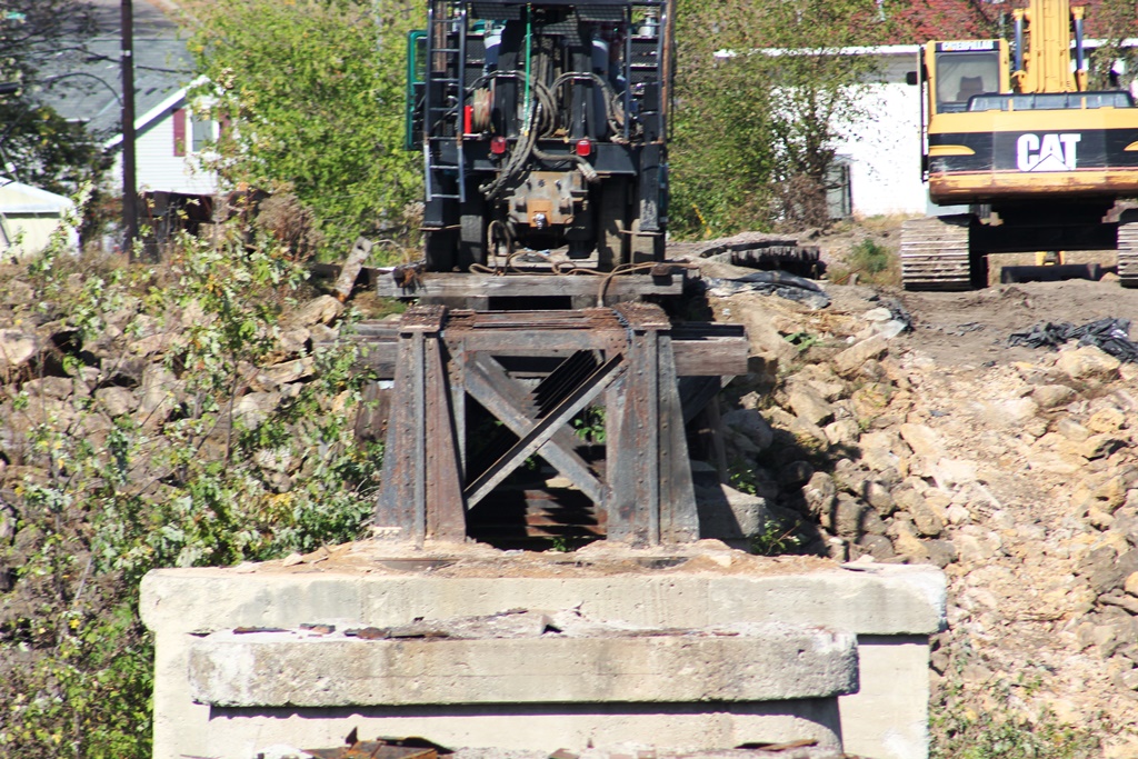
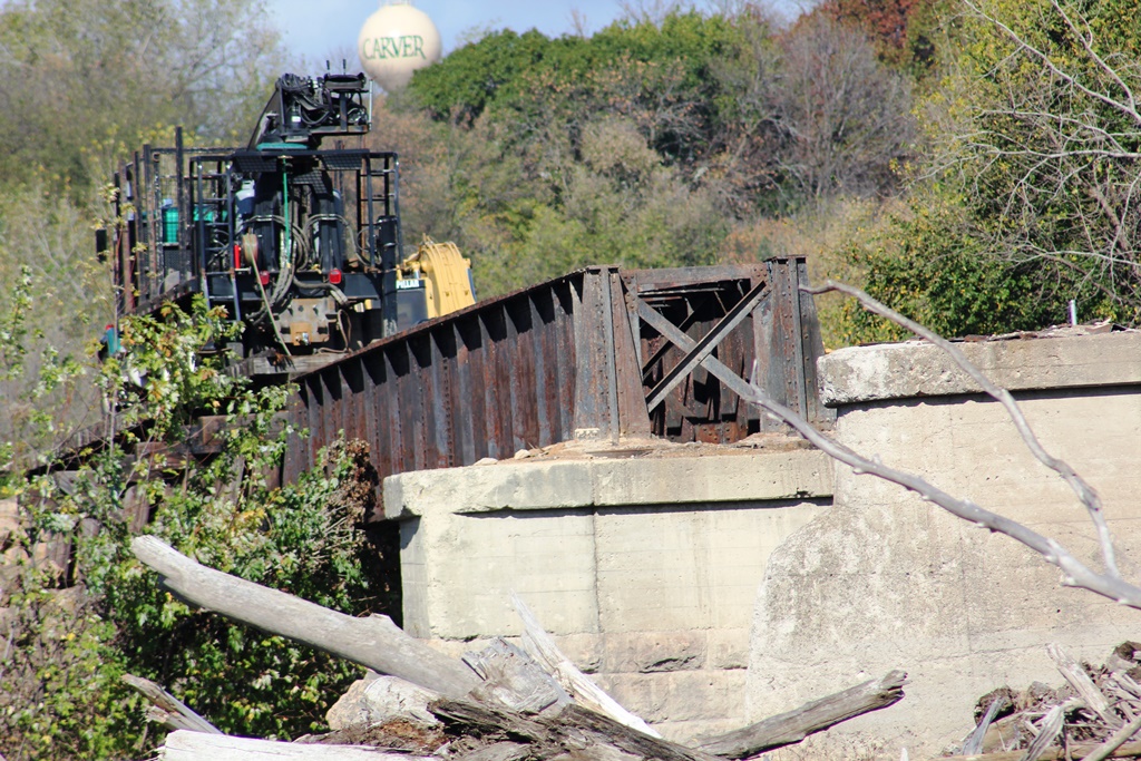
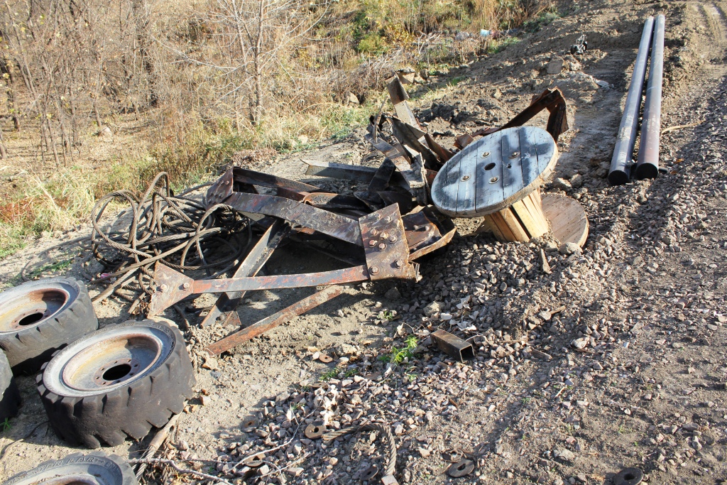
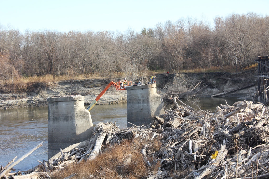
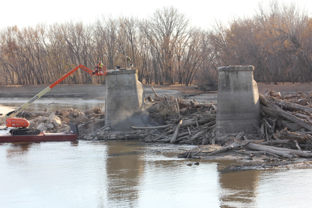
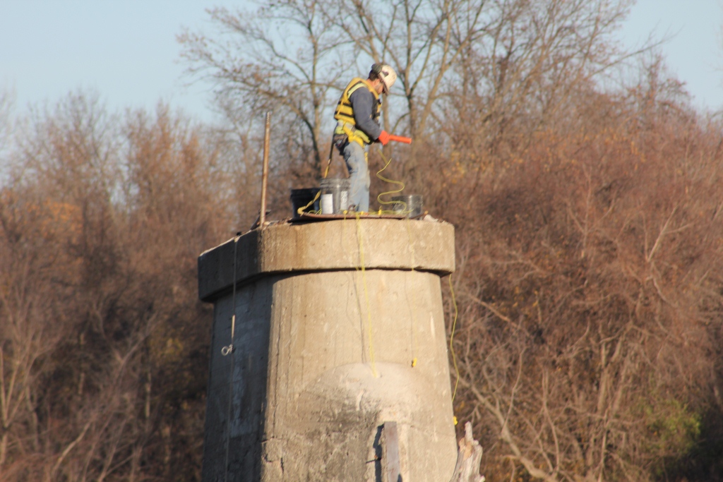
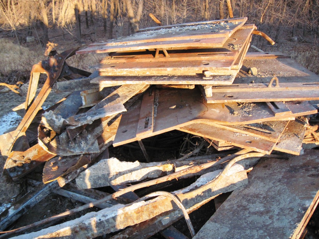
Demolition began in August of 2011, starting with the removal of the rails. A contractor, who has requested not to be named but worked on demolishing other structures for Union Pacific began by removing the rails on the bridge.
Once this was complete, holes were bored into all seven piers, preparing them for demolition. During this time, the river was exceedingly high for summer months and part of the south approach gave way under the weight of a standardized Ford F-150 pickup truck.
The railroad is exceedingly lucky they never ran a train over it during that time of high water, as the structure was severely compromised from the Flood of 2010 and that flood.
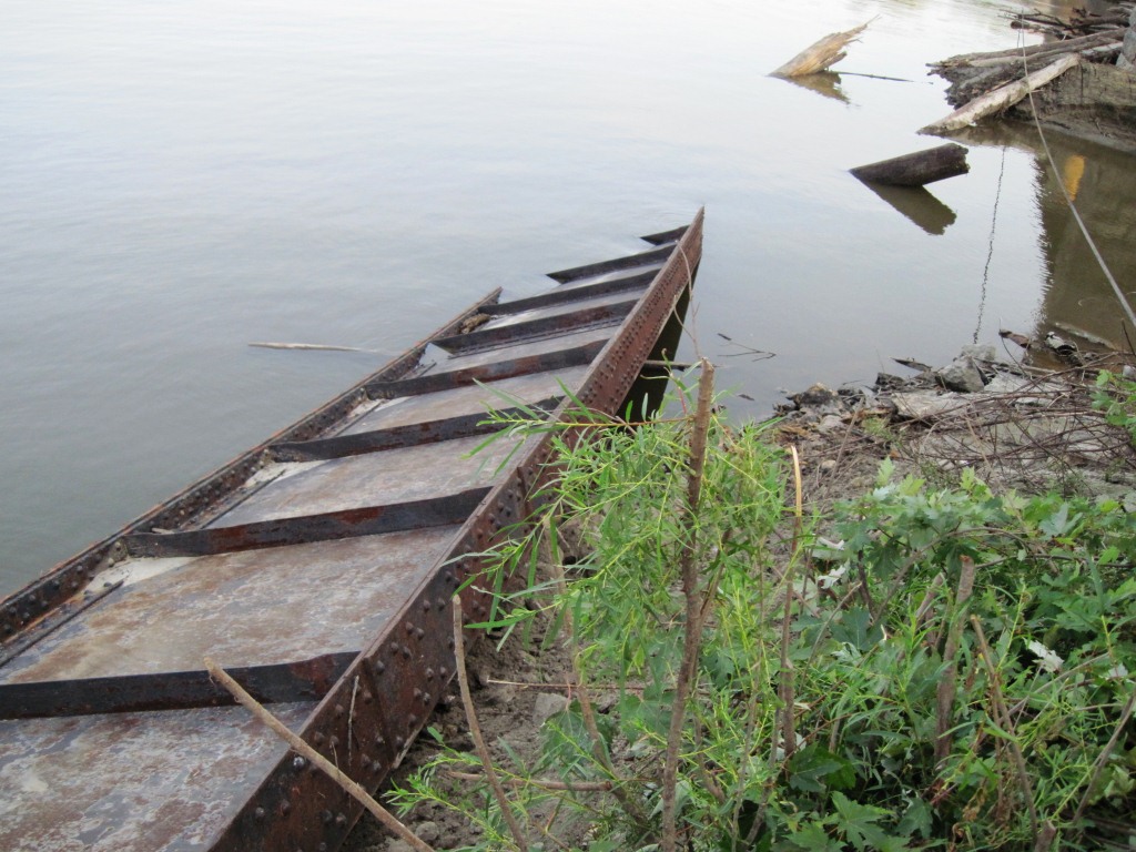
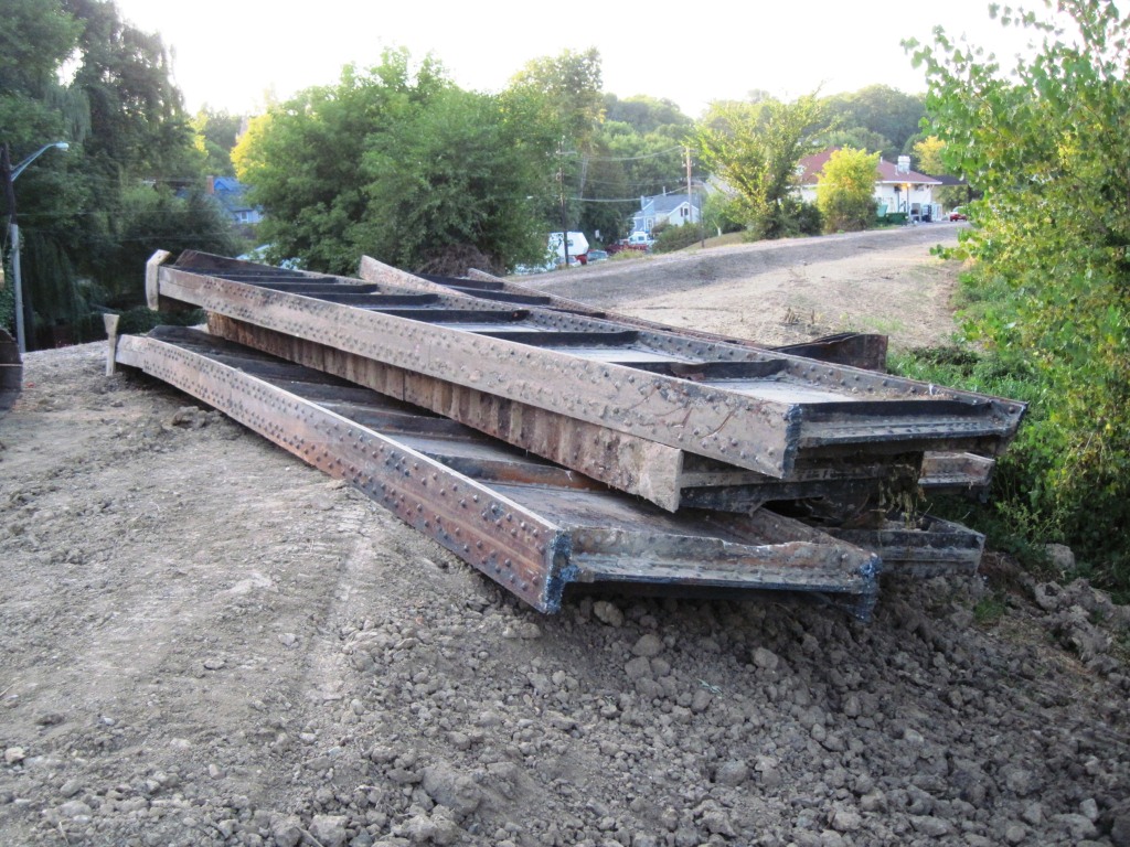
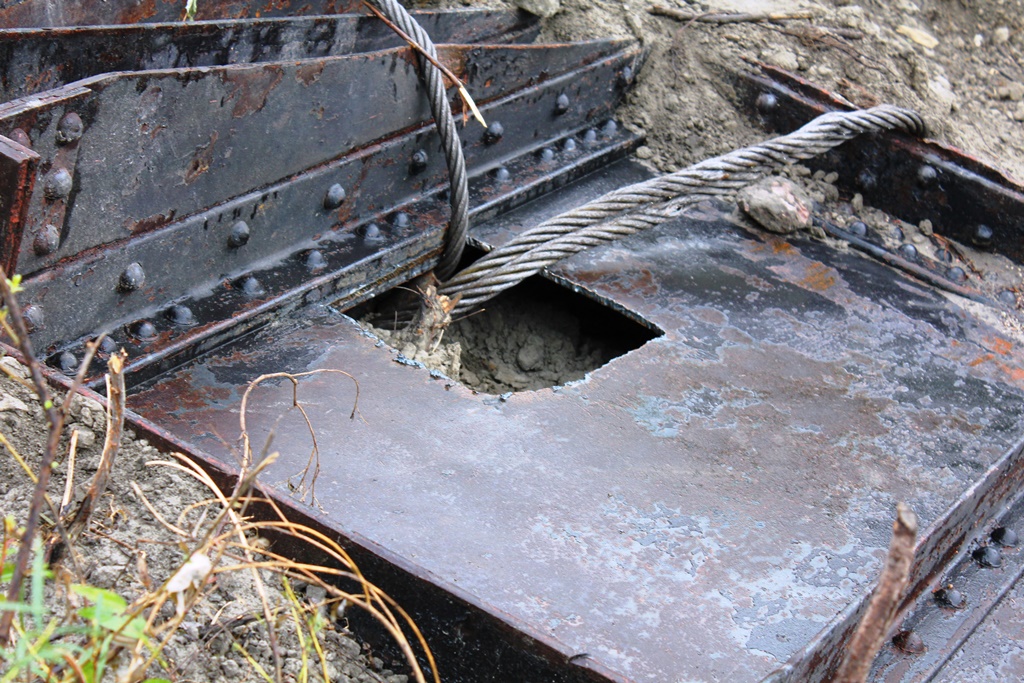
The next step was the removal of the girders. The interior bracing would be cut away, holes cut on one end of each girder and the girders pulled off the piers. A high horsepower piece of equipment pulled the heavy girder spans to the north shore, where they were cut into pieces.
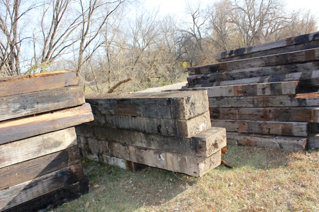
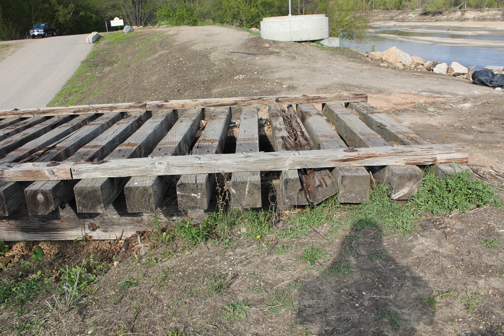
Once the girders were removed, the north approach was demolished and likely pieces were reused for retaining walls.
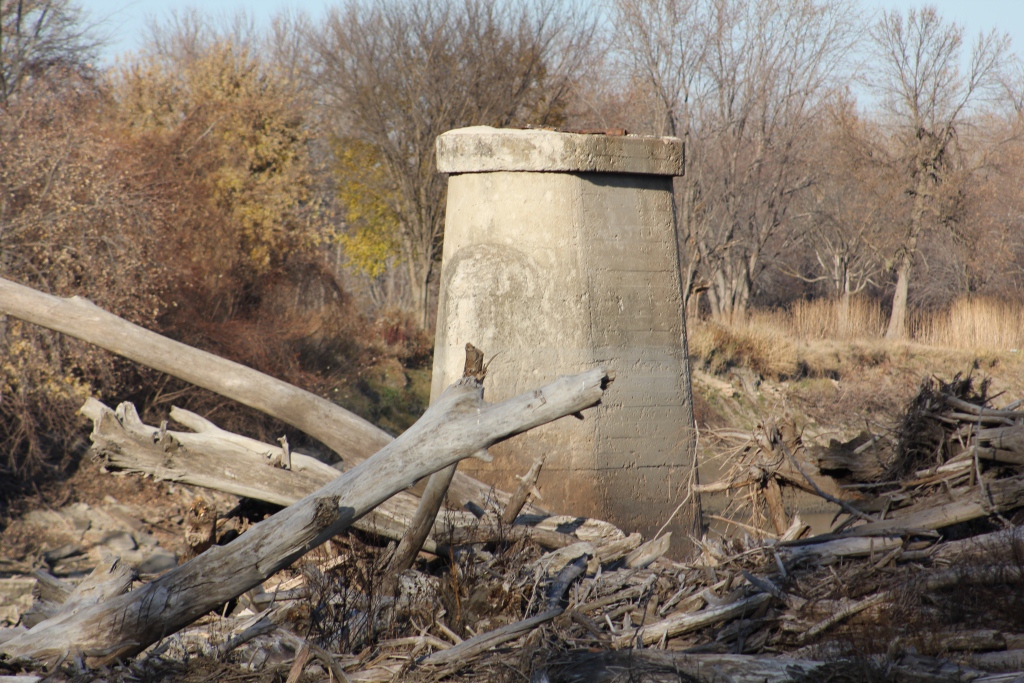
Next, the piers were removed, starting with the northern pier (#7), and eventually ending with pier #6.
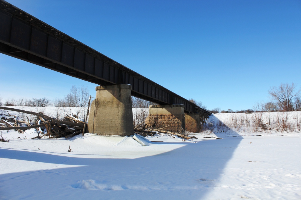
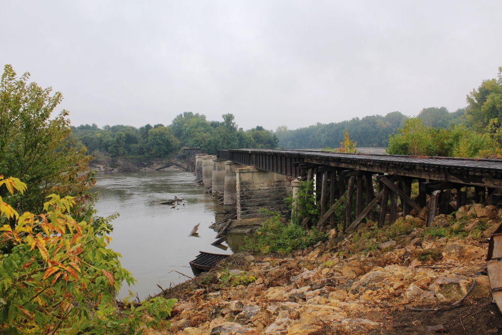
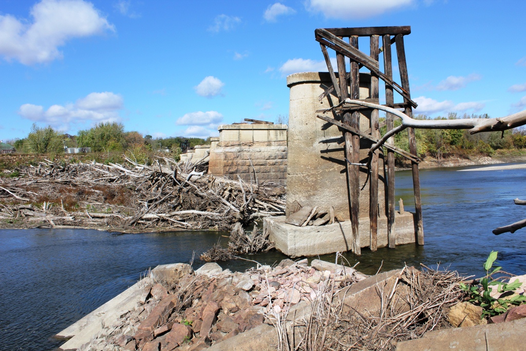
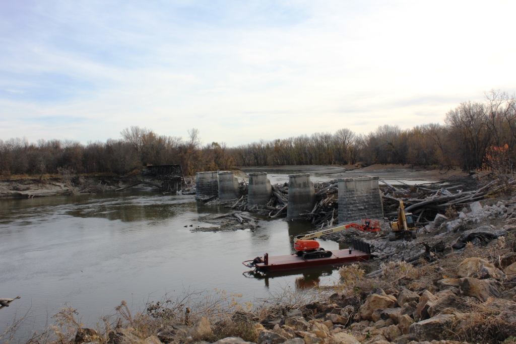
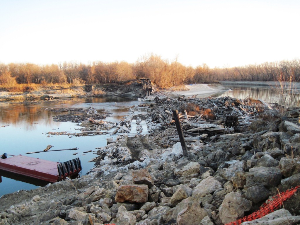
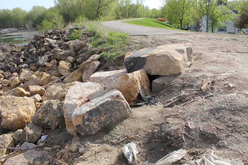
The final month of demolition included the removal of the south approach, and the final cleanup. By Christmas of 2011, there was little trace that a bridge had ever existed there.
While the author strives to present preservation of historic railroad bridges as a plus and a benefit to the community, this structure was doomed from the day it was built.
The lack of solid pilings was highlighted by a gradual shift of pier #2. Flooding in 1965 did not heavily affect the bridge, although it likely caused erosion around the base of the piers.
However, the 1991 flood did damage the bridge. This began the undercutting of pier #2, which was accelerated by the flood of 2010. A couple more large floods, and it is likely that the bridge would have ended up in the river.
Another notable issue with the structure was the space between the piers. The original configuration of the bridge included 135 feet of clear spans, while the final bridge only had 67 foot spans.
The bend on the river accelerated this issue. In 1998, a severe tornado struck St. Peter, approximately 50 miles upstream. This March storm, combined with flood waters sent large amounts of driftwood downstream, which jammed at this bridge.
Future plans for the route include a new trail connecting to the south side of the river. Unfortunately, destroying the railroad bridge left a 700 foot gap in this plan, and it is unknown if this will ever be constructed.
The author would have ranked this bridge as being moderately significant, due to the common design but uncommon side for the area.
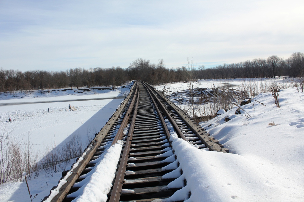
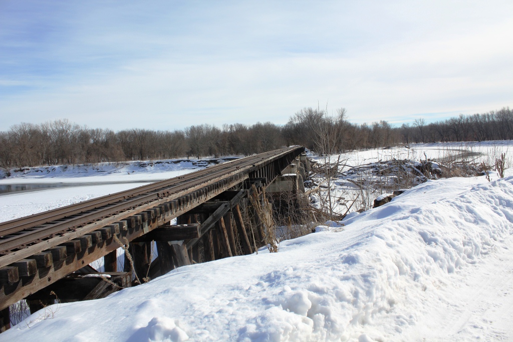
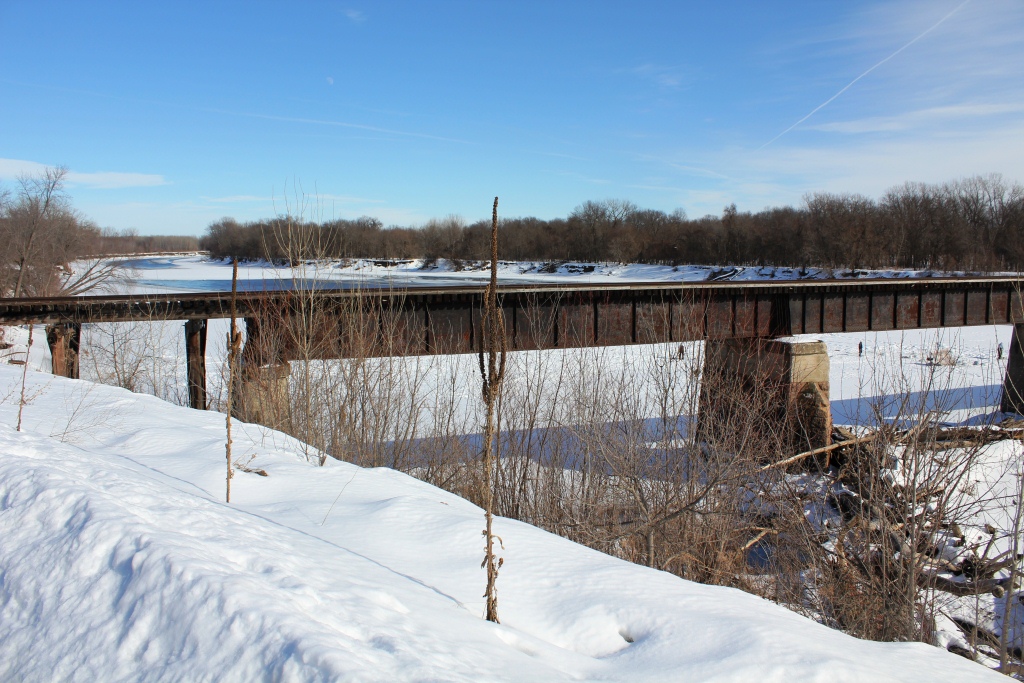
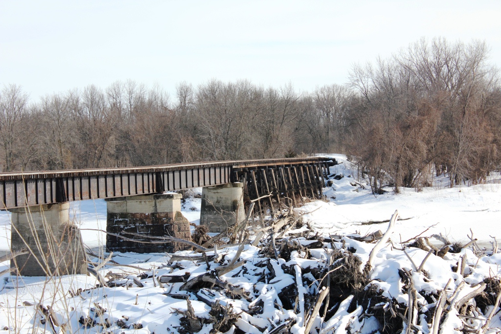
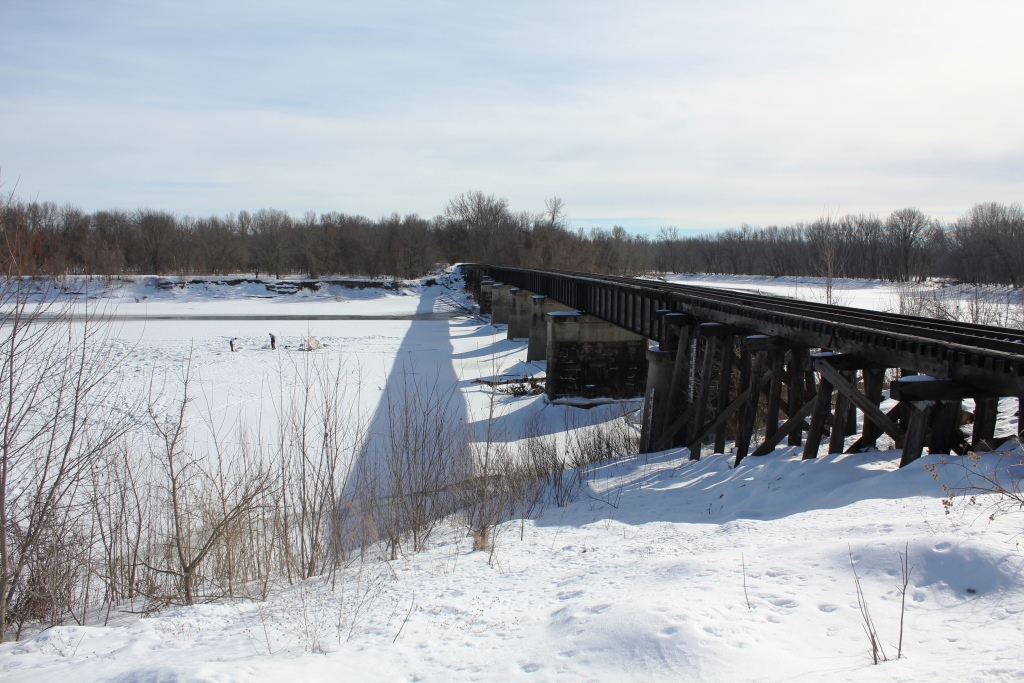
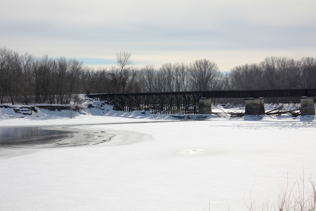
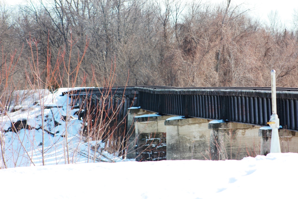
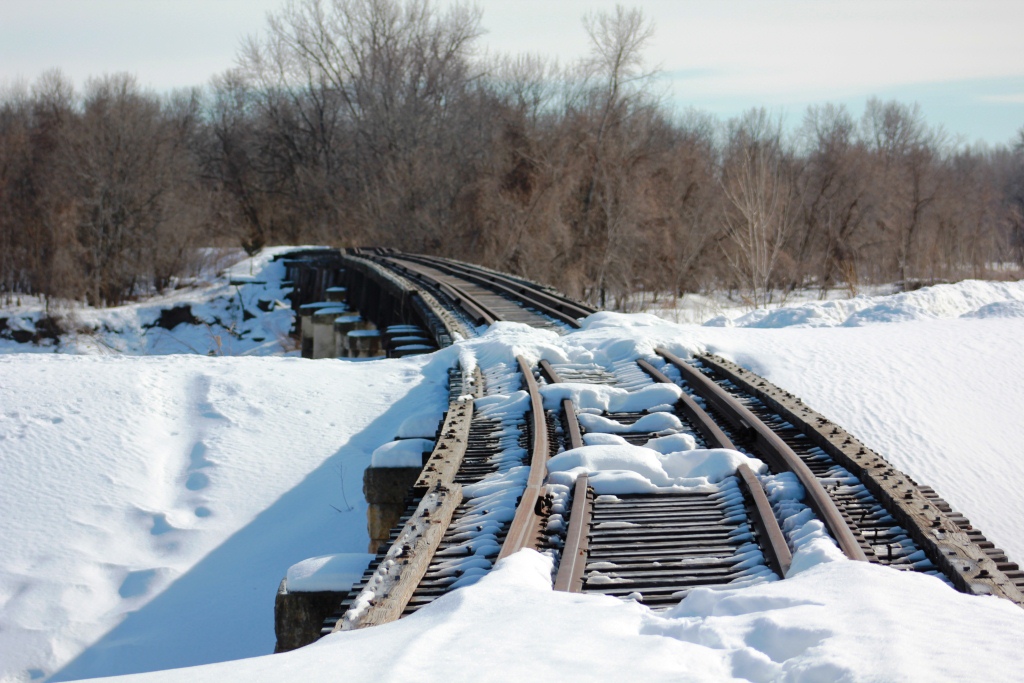
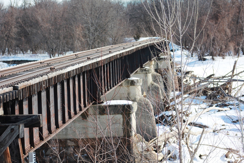
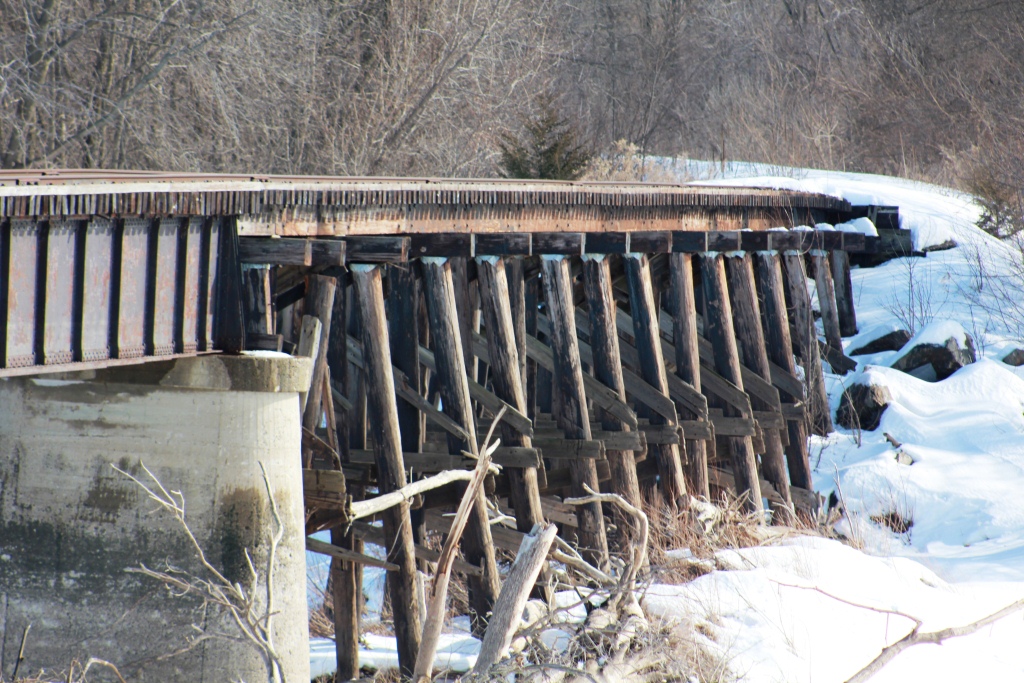
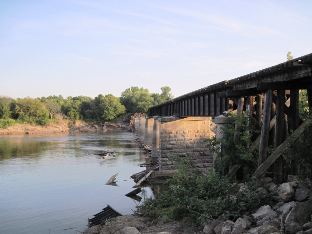
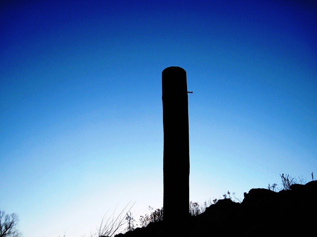
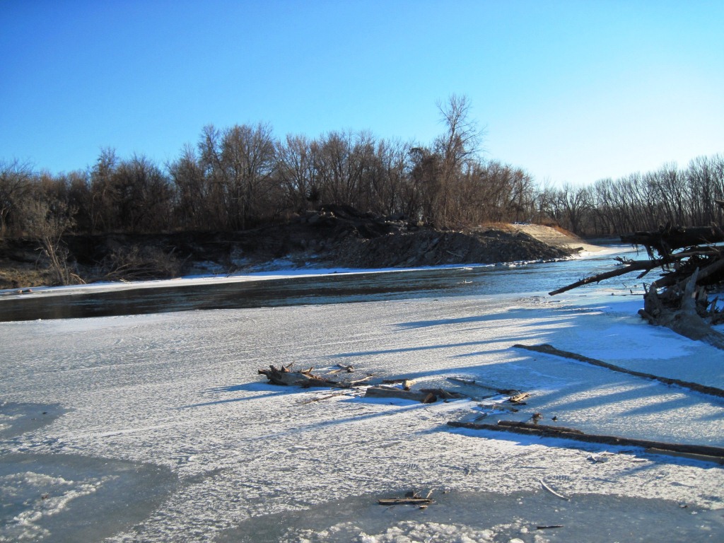
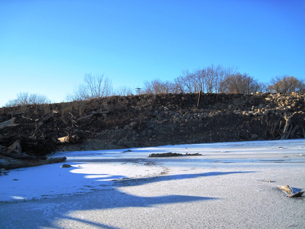
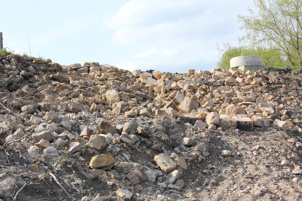
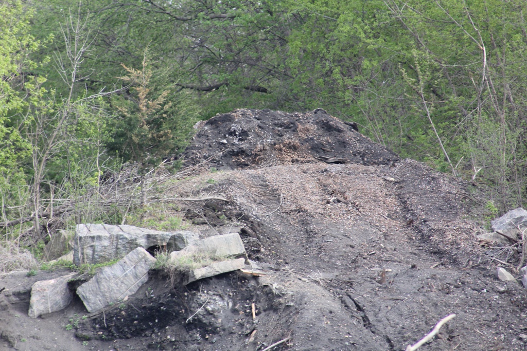
The photo above is an overview of the bridge in early 2011. The upper photo below is a of the demolition of the bridge and the photo far below shows the site as it was seen in 2012.
| Upstream | Kasota Drawbridge |
| Downstream | Chaska Swing Bridge |