logo

Boonville Lift Bridge

Through Truss Lift Bridge over Missouri River
Boonville, Cooper County, Missouri
To
New Franklin, Howard County, Missouri

Click the Photo Above to See All Photos of This Bridge!
Name Boonville Lift Bridge
Built By Missouri-Kansas-Texas Railway
Contractor (Superstructure) American Bridge Company of New York
Contractor (Substructure) Kansas City Bridge Company of Kansas City
Currently Owned By City of Boonville
Length 1,615 Feet Total, 408 Foot Main Span
Width 1 Track
Height Above Ground 10 Feet (Estimated)
Superstructure Type Polygonal Warren Through Truss
Substructure Type Concrete
Date Built 1932
Traffic Count 0 Trains/Day (Bridge is a Trail)
Current Status Rails to Trails/Abandoned
Significance Regional Significance
Documentation Date October 2016
In 1870, the Tebo and Neosho Railroad built a rail line between the Missouri/Kansas Line and Sedalia, Missouri; a distance of 110 miles.

By 1871, the railroad would be finished and a 72 mile extension built towards Moberly, Missouri. This extension crossed the Missouri River at Boonville.

Very quickly, the railroad was purchased by the Missouri-Kansas-Texas Railroad, which was beginning to build a network in Kansas.

In another part of the state, the Central Missouri Railroad was beginning construction on a 16 mile section of rail line between Hamburg and St. Charles, Missouri.

By years end, the railroad would merge into the Cleveland, St. Louis & Kansas City Railway. This railroad begun a 146 mile expansion, in two sections.
The first expansion was started in 1890, and consisted of a track roughly paralleling the Missouri River from New Franklin, at the junction of the previous line, to Hamburg.
This portion was begun in 1890. Also started was the final section between St. Charles and Machens, at the junction of a Chicago, Burlington & Quincy mainline.

The railroad would not be completed by the railroad, and instead be merged into The Missouri, Kansas and Eastern Railroad in 1892. This railroad would finish the new line.

In 1896, this eastern end would join the Missouri, Kansas & Texas Railway. These lines formed the eastern end of the system.

The first abandonment came in 1975, when the portion from Moberly to Fayette was abandoned. This line dead ended after 1923, when the MKT sold the line to Hannibal to the Wabash.
In 1978, the rest of the line north of New Franklin would be removed.

In 1982, a small spur near Columbia was converted to trail use. This led the way for the future of the remainder of the MKT line across Missouri.

The MKT line had one fatal flaw. Closely paralleling the Missouri River, it oftentimes flooded out and washed out in critical spots. In October of 1986, it would wash out again.
Officials decided not to return the track to service, and rerouted trains. The railroad between Sedalia and Machens was donated to the Missouri Department of Natural Resources. In 1990, the first section of trail would open near Rocheport.

In 1988, the Missouri-Kansas-Texas Railway was purchased by Union Pacific. By 1991, Union Pacific cut the line back to Clinton.

Despite a major setback during the Great Flood of 1993, the trail finally opened between St. Charles and Sedalia in 1996, and as far as Clinton in 1999.

The newest section of the trail is from St. Charles to Machens, which opened in 2011. Today, the trail is the nationally recognized Katy Trail, and is immensely popular in the State of Missouri.
12/03/21


View an article regarding the construction of this bridge.

The massive lift bridge at Boonville, Missouri once had an uncertain future.
However, thanks to the dedicated efforts of volunteers and politicians, the bridge will remain in place for years to come.
In 1992, the bridge was abandoned by Union Pacific. In 2004, Union Pacific developed a plan to demolish this bridge. By 2005, Union Pacific planned to build a new bridge over the Osage River using the recycled parts from this structure.
Attorney General Jay Nixon refused to let Union Pacific demolish the structure. After a fight including citizens in Cooper County, the Missouri DNR and Jay Nixon, the bridge was spared demolition.
Since then, The Katy Bridge Project has sought to advocate for rehabilitation and reuse of the massive bridge as a trail. The Katy Trail, a nationally recognized rail trail uses the rail bed on either side of this structure.
In 2016, the first segment of the Katy Bridge opened to pedestrians. Two more segments will follow, including the full operation of the lift span.

Historic Photo
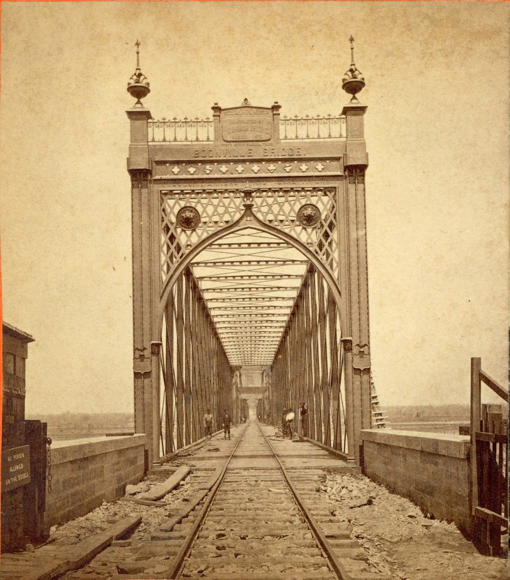
Historic photo of the first bridge

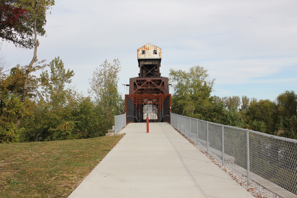
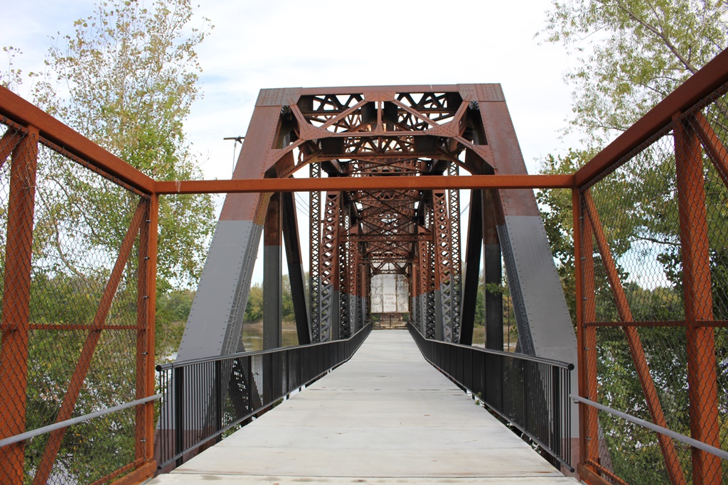
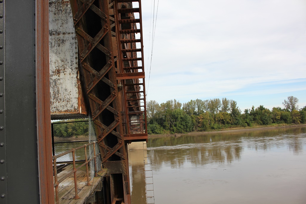
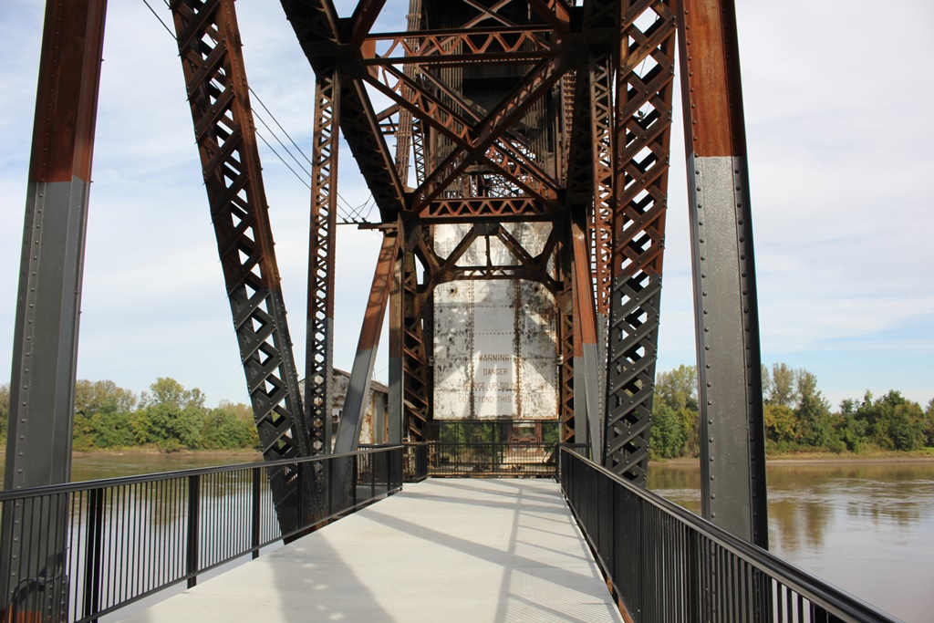
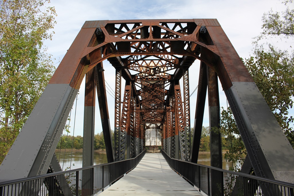
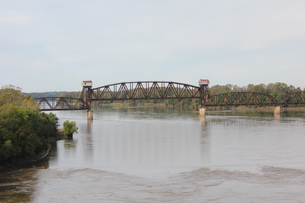
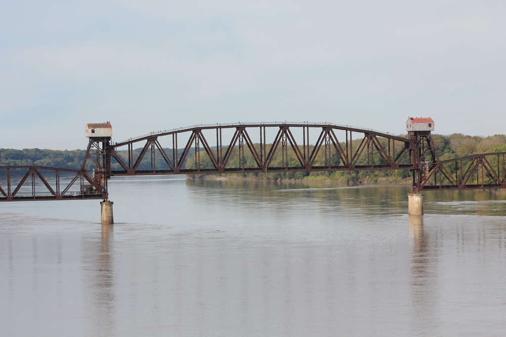
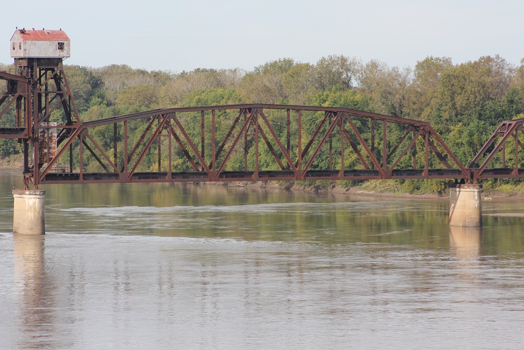
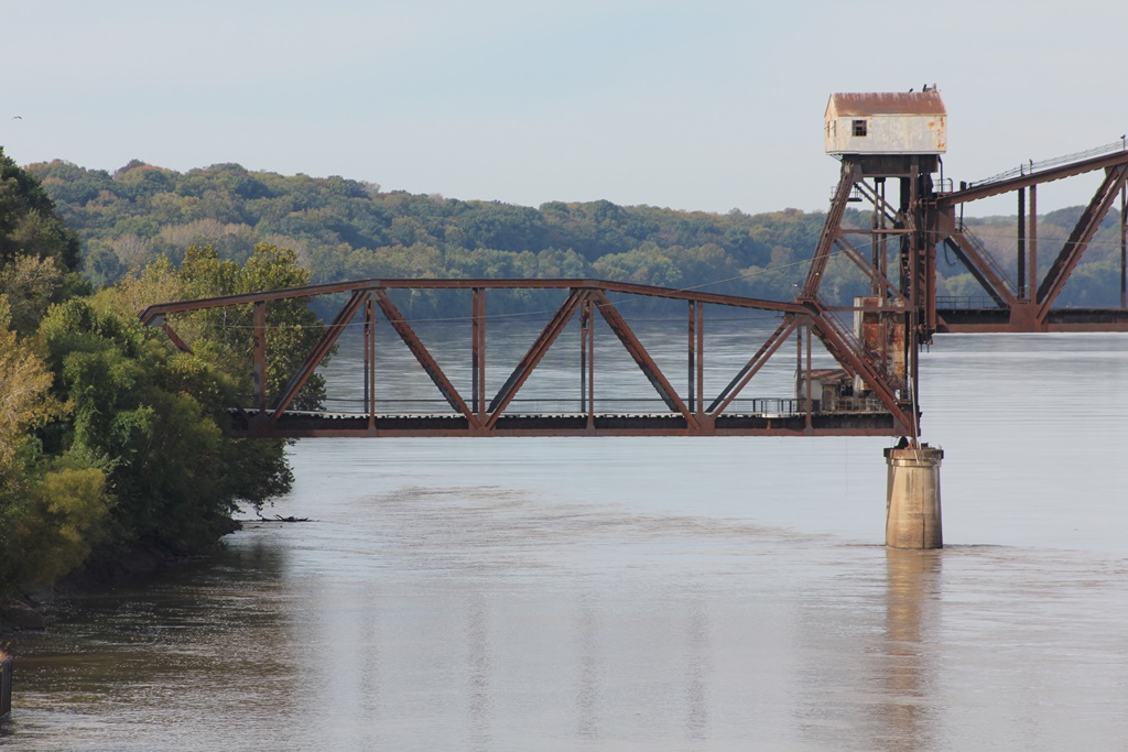
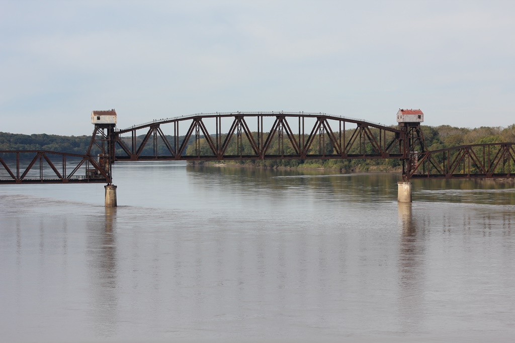
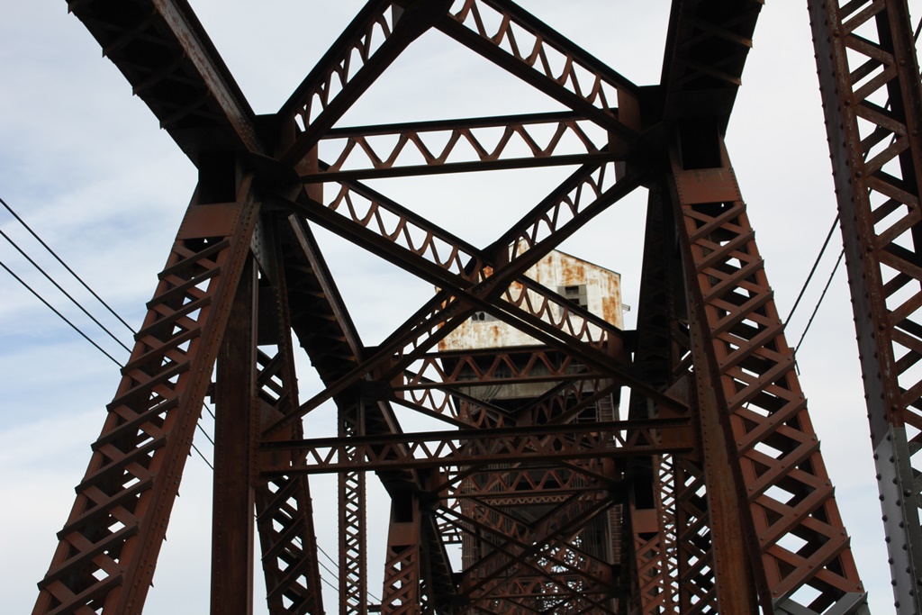
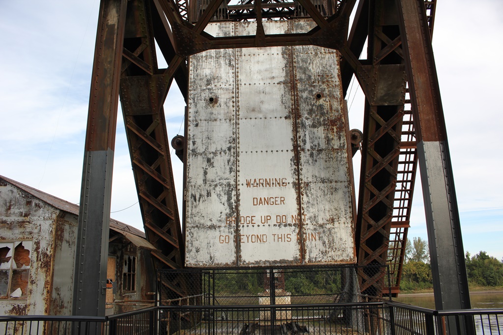
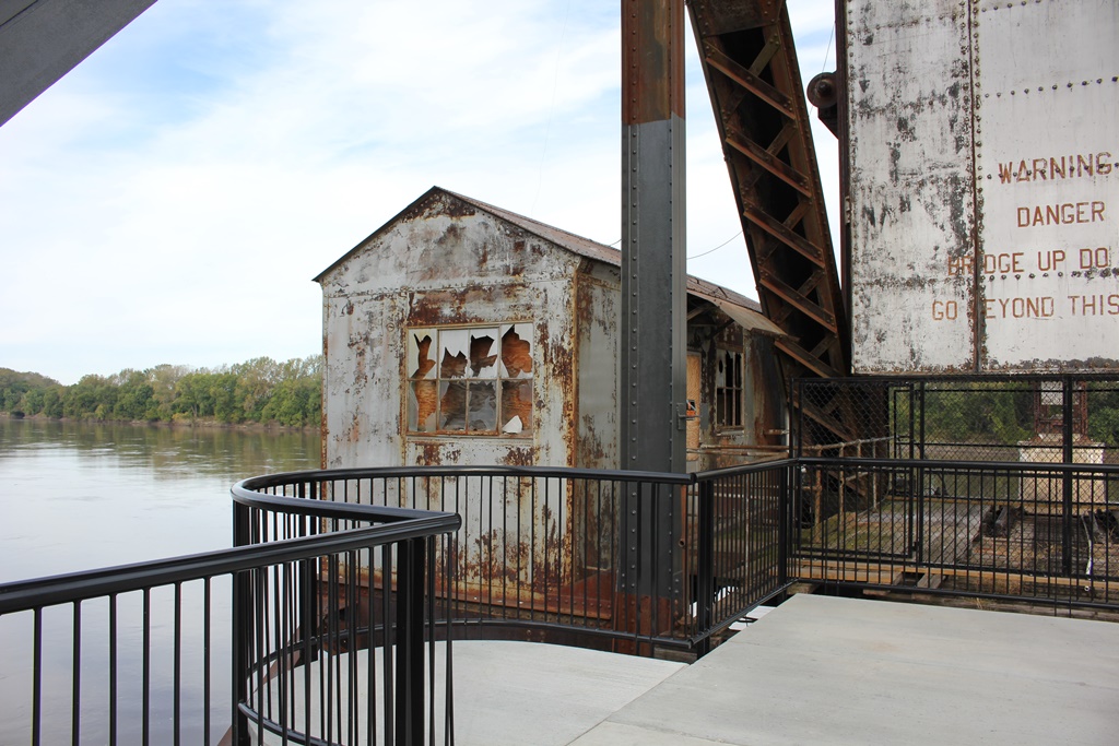
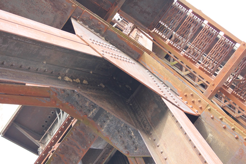
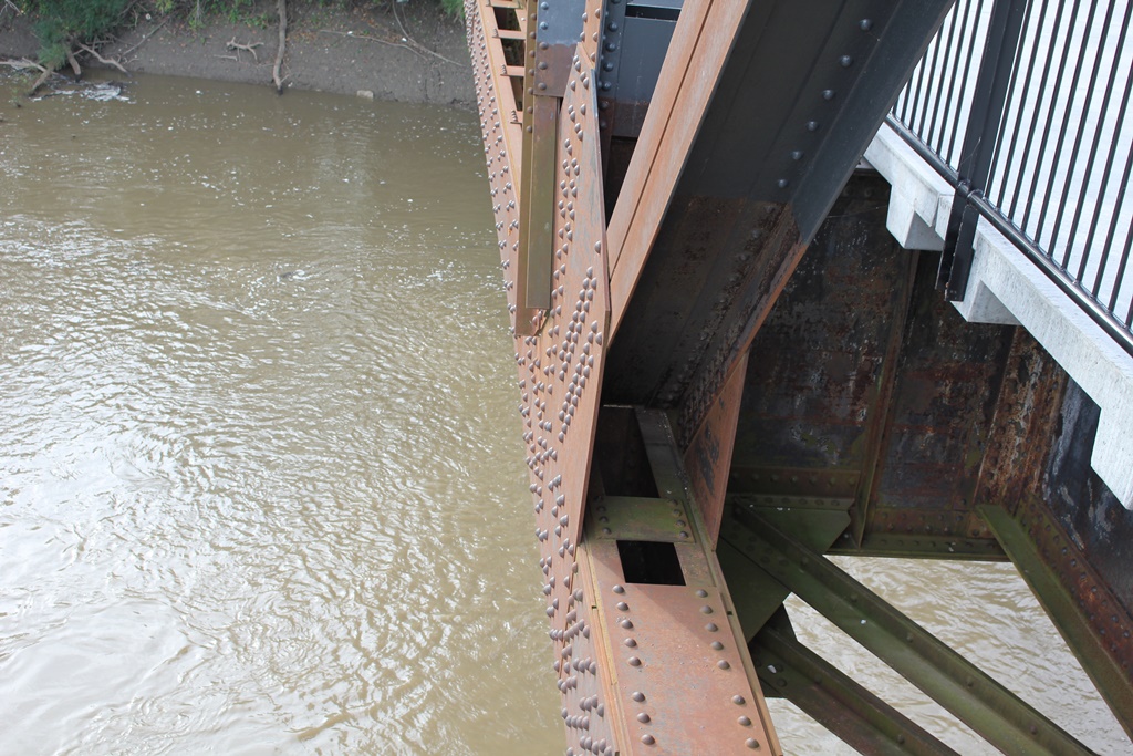
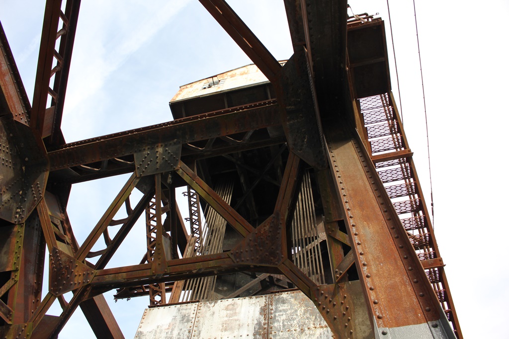
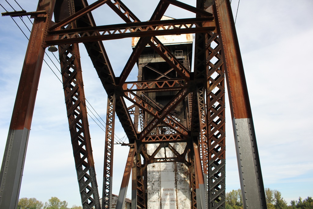
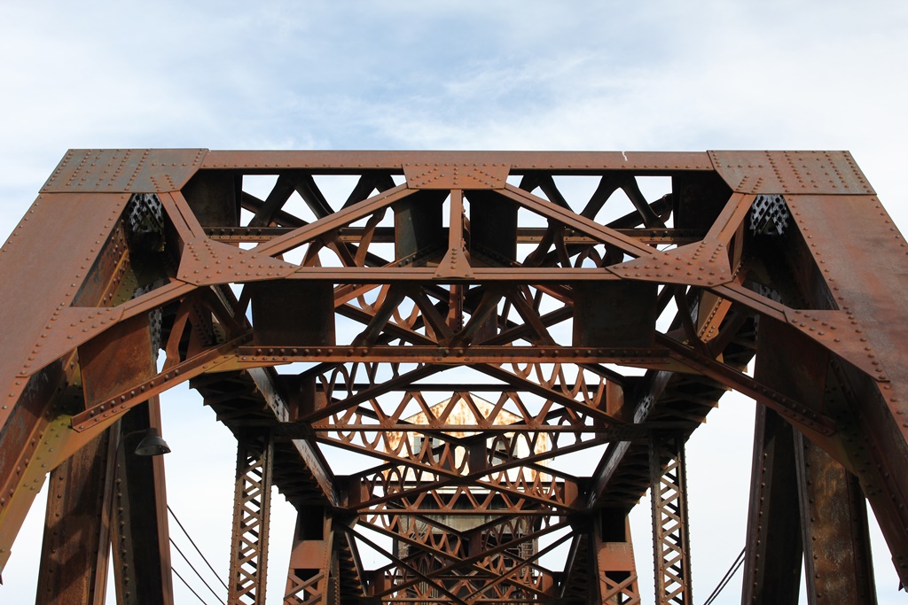
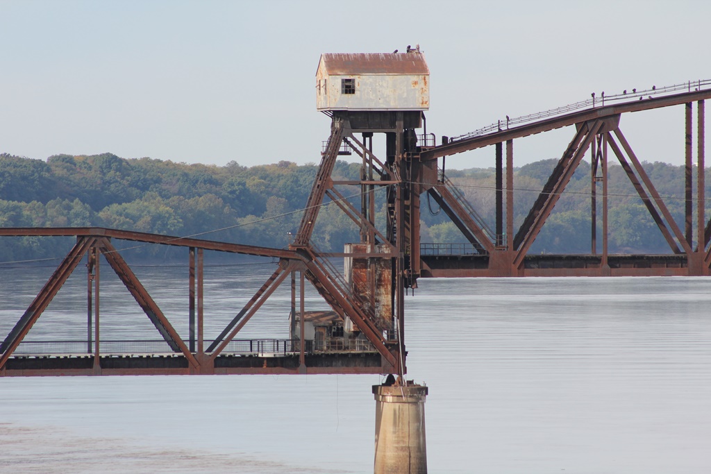
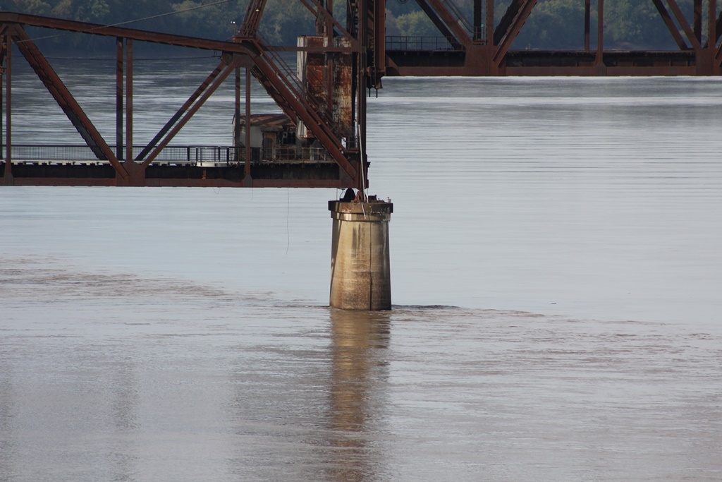
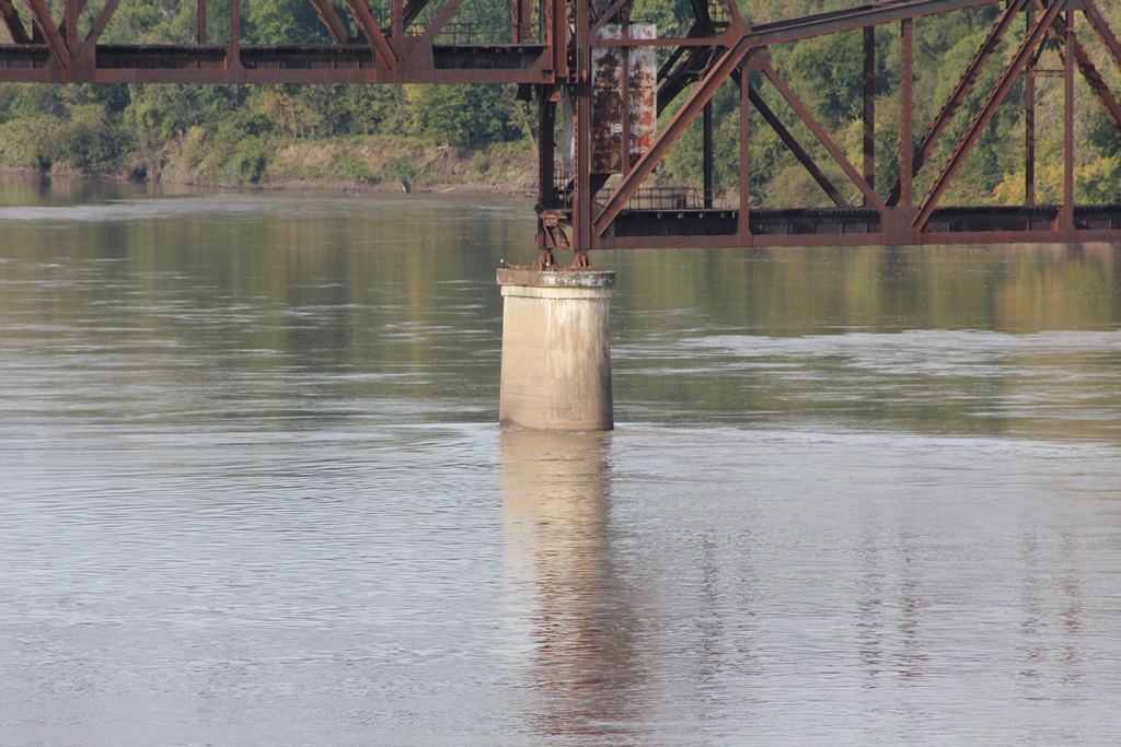
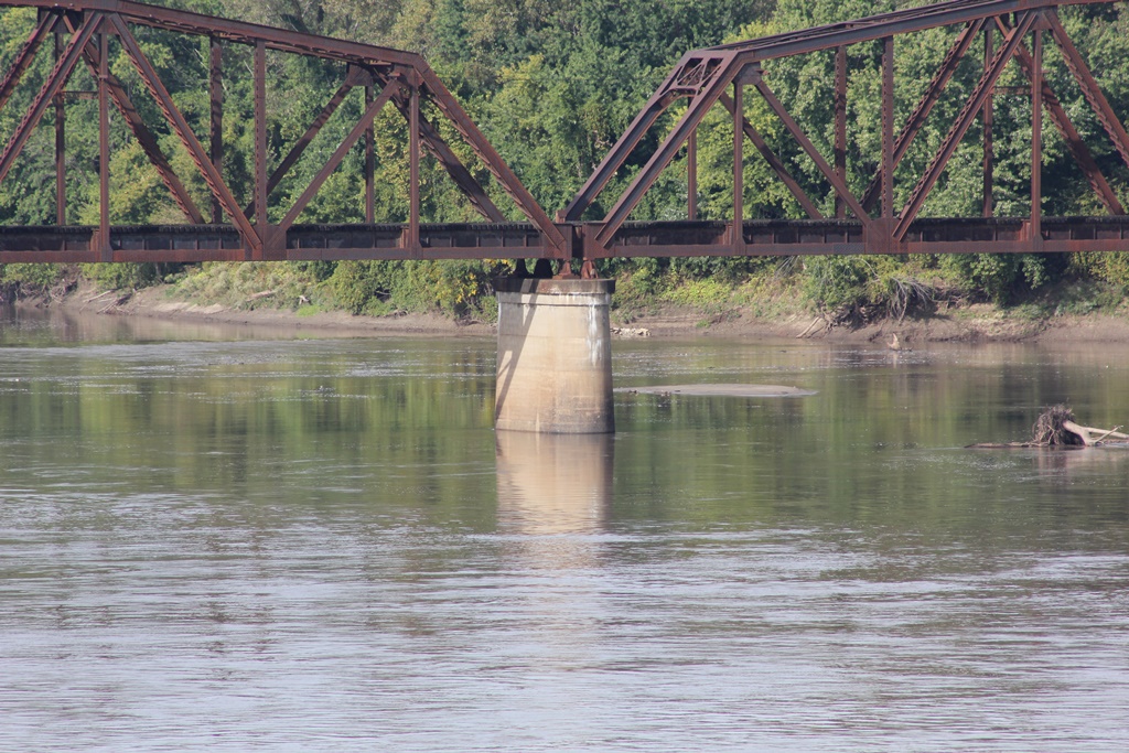
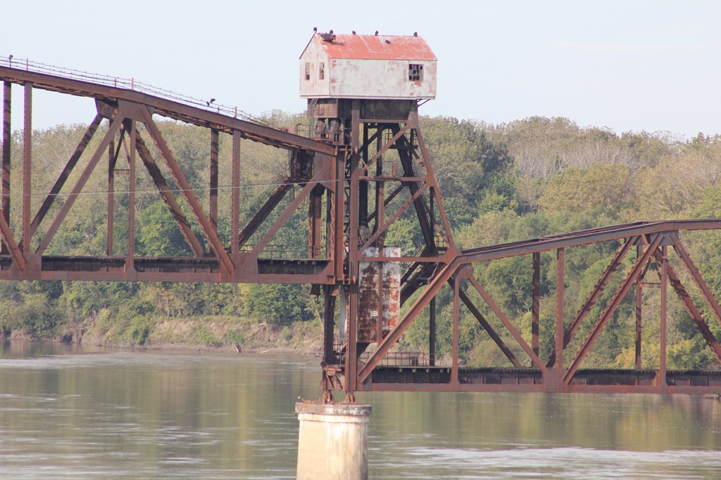
The design of the bridge is rather insignificant. A 408 foot Polygonal Warren Through Truss main span with 14 panels and riveted connections sits on towers and functions as a lift span.
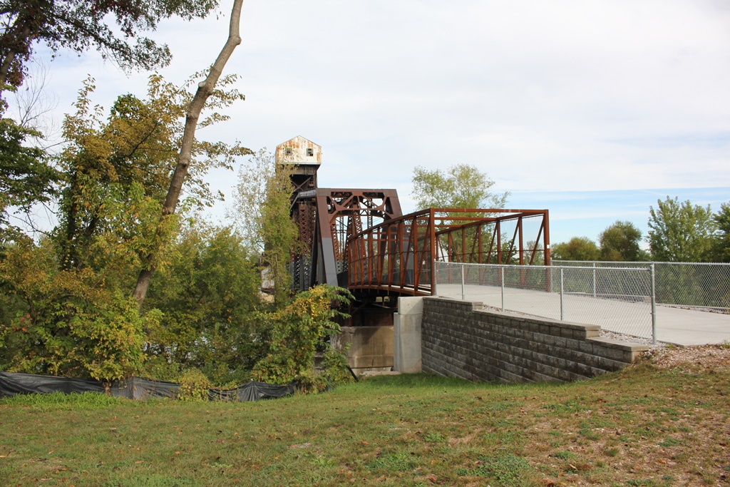
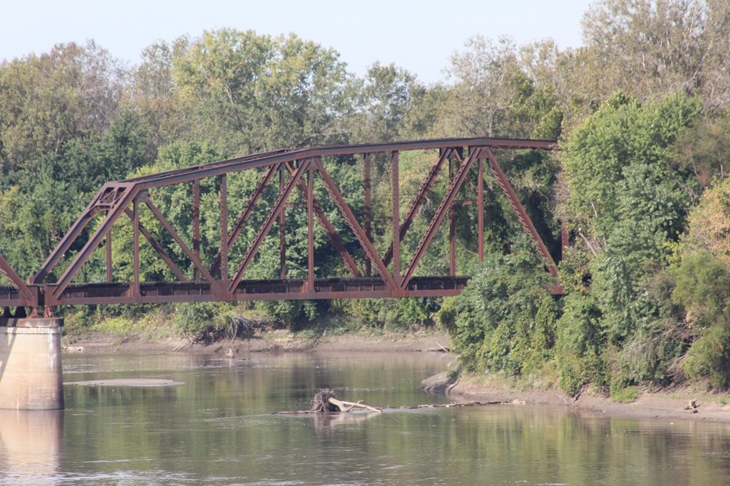
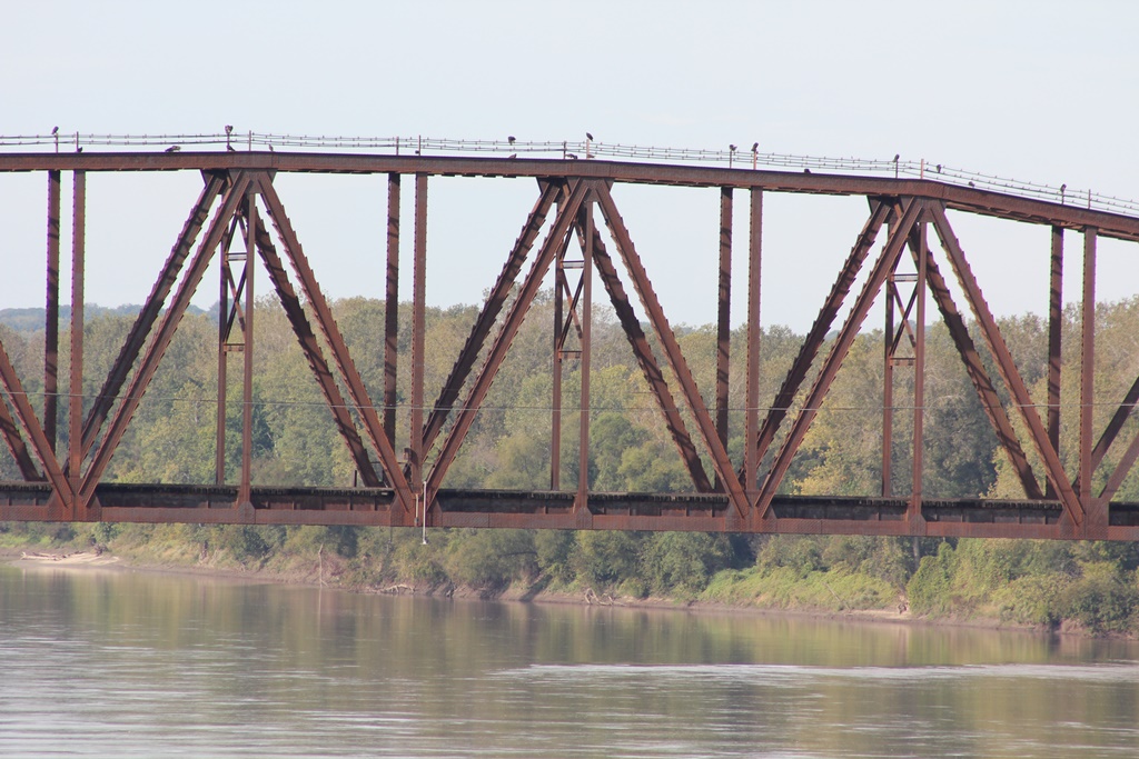
To the south, a single 8-panel Polygonal Warren Through Truss span with riveted connections spans 247 feet. A modern pedestrian span crosses the Union Pacific Railroad, to replace a 60 foot girder span.
On the north, a trip of 300 foot long 10-panel riveted Polygonal Warren Through Trusses approach the main span.
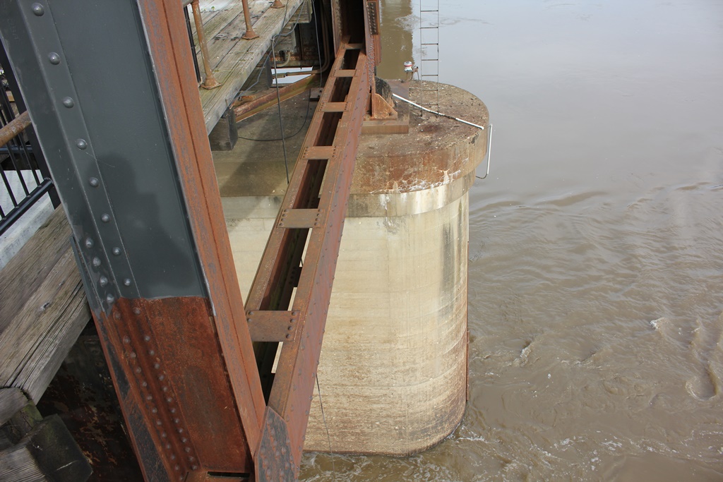
All of these spans rest on concrete substructures. The lift span is currently locked in raised position, although proposals suggest that the bridge will operate again.
These truss spans feature massively built up members, heavy lacing and a sleek 1930s look. The structure has been listed on the National Register of Historic Places.
Previous bridges at this location were a Whipple Through Truss built in 1874, and a swing bridge built in 1896.
In 2016, the first section of the bridge opened for $750,000. This section included just the south approach.

Historic Photo
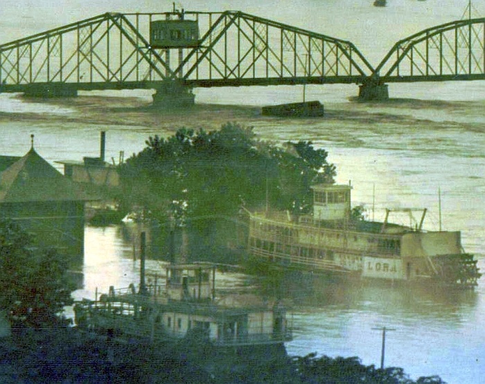
Historic photo of the second bridge

The author has ranked the bridge as being regionally significant, due to the prospect of an operational rail to trail movable span over a navigable river. The author hopes this sets the status quo for other rail to trail projects to cross similar rivers.
However, the author does not believe that the lift bridge should be the only National Register listed bridge on the Katy Trail. Several smaller yet older trusses exist along the line, yet do not see the same fame as this structure.
The photo above is an overview. The photo below shows the south lift tower. The author intends to acquire new photographs soon; including detailed listings of the north end.

Missouri River Railroad Bridges
Upstream Glasgow Rail Bridge
Downstream Old Wabash Bridge


These Pictures Start at varying points in the Series

Detail Photos from October 2016

Citations

Source Type

Source

Build Date Local reports
Railroad Line History Source ICC Valuation Information, Compiled by Richard S. Steele


Widget is loading comments...


© Copyright 2010- John Marvig and Contributors. All Rights Reserved